
In the first days of the new year, our Swiss friend G.B. was searching for a long and panoramic excursion that started directly from the town and where he could spend a large part of the day. With these preconditions we immediately connected some of the beautiful excursions proposed on our blog, giving birth to this new and appreciated proposal that we have called: Panoramic excursion of Bormio – circular route.
Panoramic excursion of Bormio – circular route
Total length of excursion: 15937 meters
Total uphill difference in height: 603 meters
Approximate total time needed for the excursion: 5 hours and 30 minutes
Difficulty: easy (4 out of 10)
Recommended season: all year round (possible presence of ice in the winter season)
Suitable for rainy days? yes (advised against in case of storm or weather alert)
General characteristics of the natural environment: meadows and forest with nice view of the Bormio valley
Presence of water\fountains on the excursion: yes
Trip on the borders of the Stelvio National Park: for the most part
Benches on the route: yes
Picnic areas on the route: yes
Alpine shelters, bars or restaurants along the route: no
Circular route: yes
Back and forth route: no
Pushchair accessible: no
Excursion starting point: Albergo Adele
Geographic coordinates of the starting point: 46°28’16.99” N – 10°22’19.50” E —- UTM: 32T 605333 – 5147339
Altitude of the starting point: 1240 meters asl Maximum height reached on the excursion: 1935 meters asl
Description of the excursion: Panoramic excursion of Bormio
In the first days of the new year, our Swiss friend G.B. was searching for a long and panoramic excursion that started directly from the town and where he could spend a large part of the day. With these preconditions we immediately connected some of the beautiful excursions proposed on our blog, giving birth to this new and appreciated proposal that we have called: Panoramic excursion of Bormio – circular route.
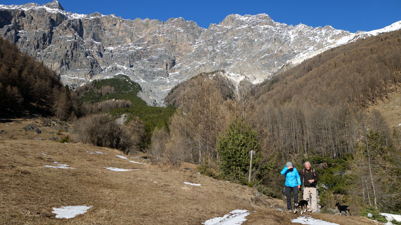
An excursion rich in incredible environmental changes and spectacular landscapes. A pleasurable long excursion in the mountains, not far from the centre of Bormio.
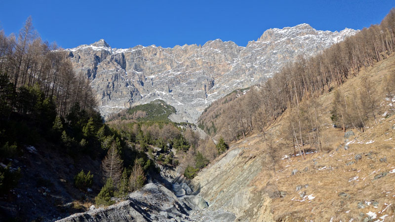
The large number of crossroads and intersections that characterize this excursion have obliged us to reduce the description of the landscapes, environments and places passed along the route; from the meadow of San Gallo with its medieval church, the Ferriere Corneliani, the park of Bagni di Bormio with its Pliny water spring, the medieval building of Bagni Vecchi and the church of Saint Martin, the dolomite wall of mount Reit, the incredible Pedemontana of Reit, the Casina Bassa area, the military mule track of Ables and the church of SS Trinity of Teregua.
An excursion where landscape, history, art and tranquility can make you feel many emotions.
Description of the excursion:
From Hotel Adele you turn right and go uphill along Monte Braulio street. After a few meters turn left onto San Sebastiano street and a bit further turn right on Martinelli street. Initially on the secondary street and later on the cycle path you can reach the church of San Gallo without difficulties. (click here for the schedule of the walk to the church of San Gallo).
Once you reach the picturesque Church, turn right and go slightly uphill and continue, always on the cycle path, to the houses of Premadio. Turn right and go uphill along Similiore street and after about 50 meters, going slightly downhill, take a left onto Adda street. At the end of Adda street the route becomes a cycle path again.
Continue without changing direction until the “Ferriere Corneliani” (click here for the complete description: The walk to the Ferriere Corneliani).
From the Ferriere Corneliani
At the end of the cycle path, near the playground of Ferriere Corneliani, turn right and go uphill onto Forni street and continue straight until you reach the bridge of the national road 301 of Foscagno.
Cross the bridge and immediately turn left on the ancient road to Bagni Nuovi, now blocked by large stones. A few meters after the stones, turn right at the hairpin bend and continue straight without any difficulties until the “Bagn de li bescia” (bath of the sheep – a pool of thermal waters where, since ancient times, the sheep have been washed before shearing).
From the Bagn de li Bescia
From the “Bagn de li bescia” continue straight until the end of the field where, near an iron barrier, you turn left. Proceed on a flat track and at the next intersection turn right and go slightly uphill. Crossing a short tract in the wood the route runs along a field and, always going uphill, you reach the “Parco dei Bagni” stone road near the ruin of the old thermal water bottling plant.
Once you reach the intersection with the walk to the Pliny water spring, you should turn left.
Cross the little valley and continue for a few hundred meters until you reach the thermal spring.
From the Pliny thermal spring
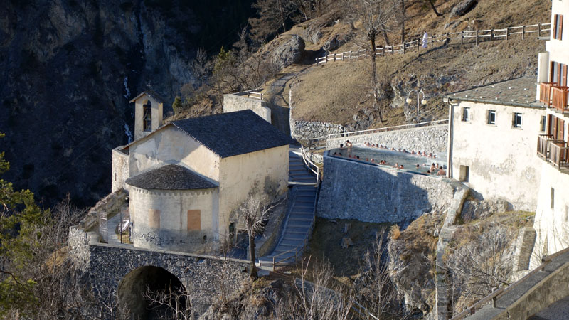
From the Fonte Pliniana (Pliny thermal spring) you follow back the way you came for about 100 meters and then turn left, on a single track going uphill, in the direction of Bagni Vecchi. In a few minutes you will reach the San Carlo thermal spring.
Once you reach the water spring turn left, always going uphill in the direction of the Bagni Vecchi, along a short tract of the ancient Imperial road of Umbraglio.
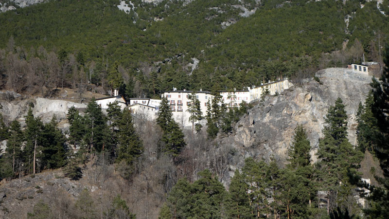
From the little square in front of the building of Bagni Vecchi you continue uphill until you reach the national road 38 of Stelvio. Cross the tunnel and the panoramic bridge, and continue slightly downhill until the end of the car park that you find on your right.
A few meters beyond the car park, a track starts through the wall on the left side of the road. Take the track (track of the aqueduct) and follow it until you meet the Pedemontana of Reit mule track in locality Pravasivo.
From Pravasivo
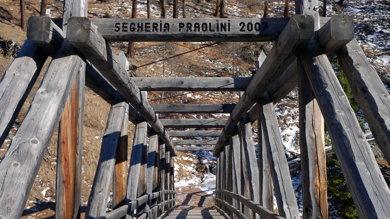
Once you reach the wooden house of Pravasivo turn left and follow the Pedemontana of Reit until its end (click here for the complete description of this route). Walk for a little more than 3 kilometers on the magnificent road, crossing the valley of Campello and the picnic area of Planon dei Laresc until you arrive at a little shrine.
From the little shrine at the end of the Pedemontana go downhill (the first few meters are steep) until you arrive at a T junction. Here turn left and go uphill along route 511 in the direction of Canareglia – San Nicolò.
A short and steep walk uphill will bring you to a field with a big wooden manger. Cross the field and continue on trail 511. A few minutes walk, surrounded by a fabulous larch wood, brings you to the mountain pasture of “Casina Bassa”.
From the Casina Bassa
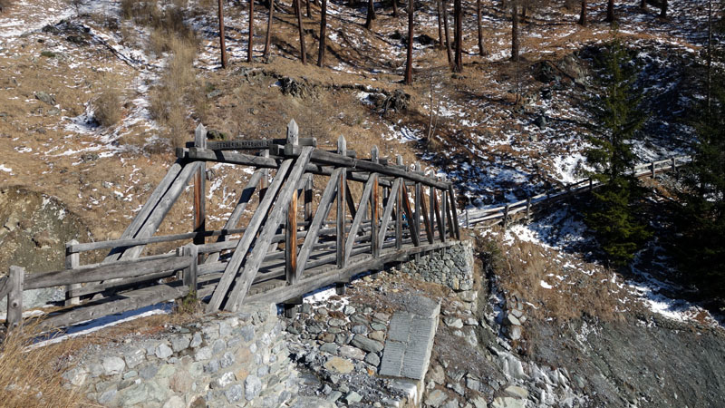
From the mountain house go up diagonally for some tens of meters until you reach a clear red sign where the road becomes more obvious again. Continue east on route 511 crossing two little valleys, the first on compact gravel and the second on a characteristic wooden bridge.
A short walk uphill, on an easy mule track, takes you to a new crossroad where you stay on the right and, going slightly downhill, you continue in the direction of Teregua – Uzza.
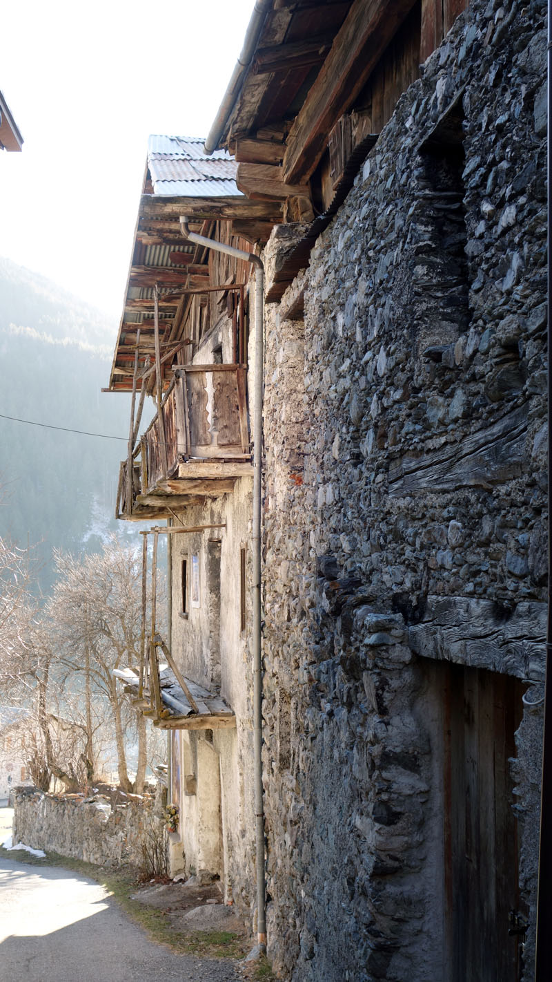
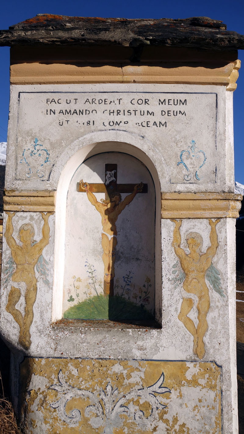
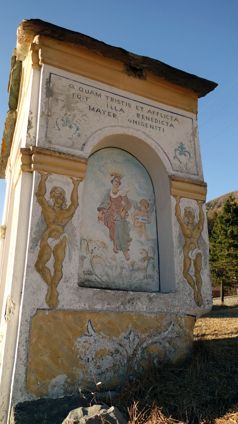
A beautiful military road, with a slight slope, goes down to the meadow and houses of “Teregua”. Once you arrive at the village continue straight and go downhill past an ancient house enriched by a centuries old fresco. A few meters ahead you will reach the little fourteenth century church of SS Trinity.
From Teregua
From the church turn right on Teregua street and after that turn left on Rezzon street, near a beautiful painted chapel. Always going downhill you will reach the intersection with the provincial road of Gavia where you should turn right in the direction of “Uzza” village. A few meters before the Uzza bridge turn left and go downhill in the direction of the cycle path. At the bottom of the steep road cross the bridge over the river Frodolfo and continue in the direction of Bormio along the cycle path.
In about 1 kilometre you will arrive at a small dam of a2a. Thanks to the route over the dam you can cross the river Frodolfo again and continue on a stone track until you reach the main road to Gavia and Santa Caterina. Turn right and go uphill and after 30 meters along the main road turn left on an easy and panoramic trail that, passing the old graveyard, goes in the direction of Bormio. Continue on this trail until its end.
Once you arrive in the old town centre of Bormio, turn left and continue slightly downhill along Alberti street. At the end of Alberti street continue straight along Sermondi alley and after that go up to Buon Consiglio street (De Simoni palace – Bormio Museum) that you follow until its end where you find the intersection with San Francesco street. Go straight downhill along San Francesco street until you reach Monte Braulio street. Turn right and go uphill on Monte Braulio street and in a few minutes you will return to Hotel Adele.
Enjoy your walk!
Stefano and all of the Albergo Adele staff
Text translated by Stefano Bedognè and Paul Faller (teacher at MyEnglish Lodi)
escursionismo a Bormio – un’ opportunità in più!


COPYRIGHT AND LEGAL POLICIES – UPDATED Mar. 9th 2021
All contents of this blog (text, graphic elements, images, pictures, videos, etc.) are exclusive property of Stefano Bedognè and Albergo Adele s.a.s. and they are protected by Italian and International copyright laws. Therefore only viewing is allowed. Copying, either partial or total, will be allowed only after explicit request and authorization. In this case it must be indicated on the copy the source: www.albergoadele.it. Any other use (distribution or publication for profit, modification, processing in any way or form, etc.) will be considered unauthorized and will be prosecuted by law.
The information provided on this page, on our website and on the blog in general, are finalized to promote the touristic and cultural opportunities of Bormio and Valtellina but they are not substitutions in any way for professional accompaniment or the direct consultation of professional workers.
All of the excursions described on this website are for the purposes of promoting Bormio and Alta Valtellina. Every hiker has to consider independently their physical condition, personal experience and ability. The hiker has to check independently the trail complexity based on personal conditions, trail conditions and weather conditions, including the presence of ice, snow, landslides, avalanches or other events. Albergo Adele and Stefano Bedognè don’t assume any responsibility for any accident occuring to the trekkers during the trip here described. Albergo Adele and Stefano Bedognè always suggest being accompanied by a Mountain Guide.
