

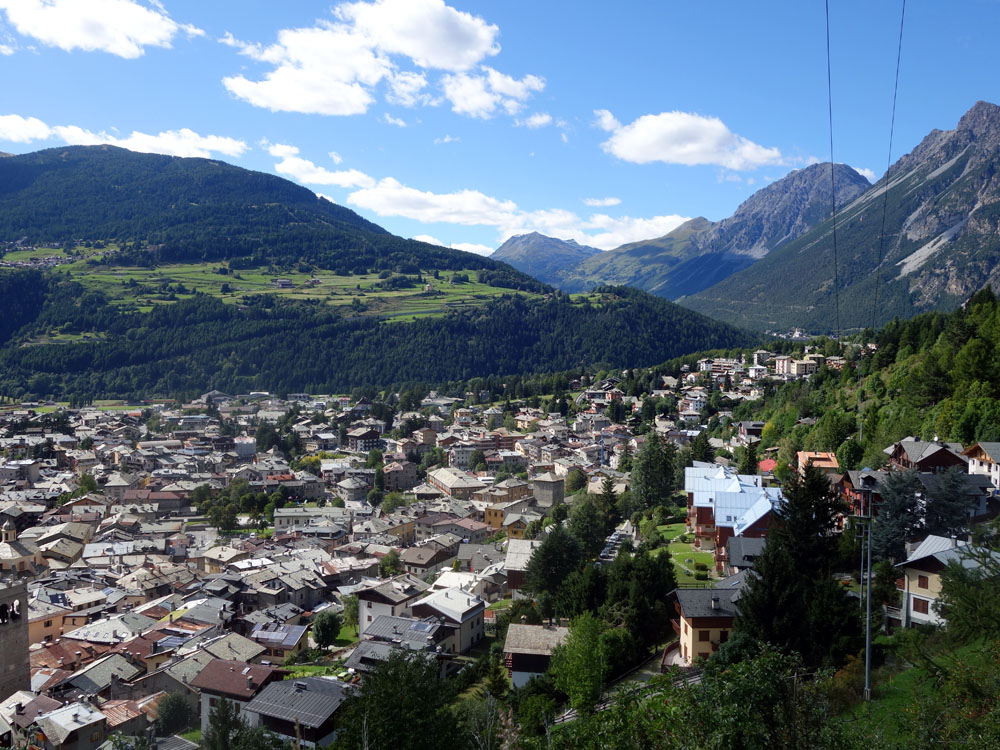
Excursion to the Cross of Reit – Circular route from Casina Alta, Paluetta e Sasc Frasc
Total length of excursion: 12500 meters
Total uphill difference in height: 964 meters
Approximate total time needed for the excursion: 4 hours
Difficulty: medium (5 out of 10)
Recommended season: from the end of April to November (check the snow situation in November)
Suitable for rainy days? yes
General characteristics of the natural environment: larch, stone pine (P. Cembra) and mountain pine (P. Mugus ) forest
Presence of water\fountains on the excursion: no (not always)
Trip on the borders of the Stelvio National Park: yes
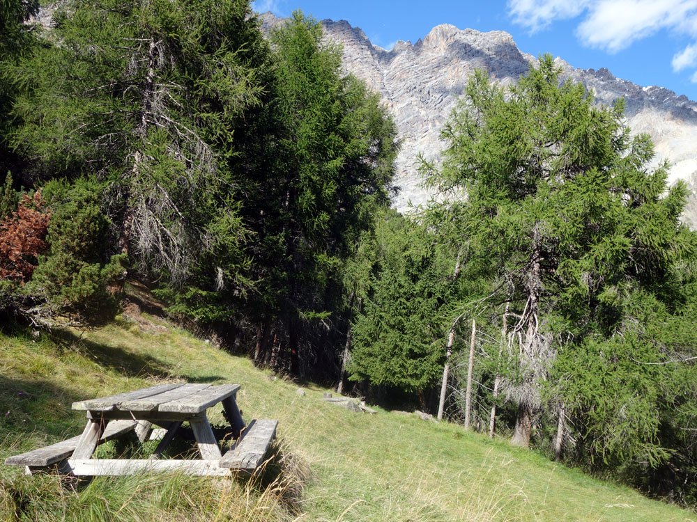
Benches on the route: yes
Picnic areas on the route: yes
Alpine shelters, bars or restaurants along the route: no
Circular route: yes
Back and forth route: no
Pushchair accessible: no
Excursion starting point: Albergo Adele
Geographic coordinates of the starting point: 46°28’16.99” N – 10°22’19.50” E —- UTM: 32T 605333 – 5147339 Altitude of the starting point: 1250 meters asl Maximum height reached on the excursion: 2120 meters asl
Description of the excursion to the Cross of Reit
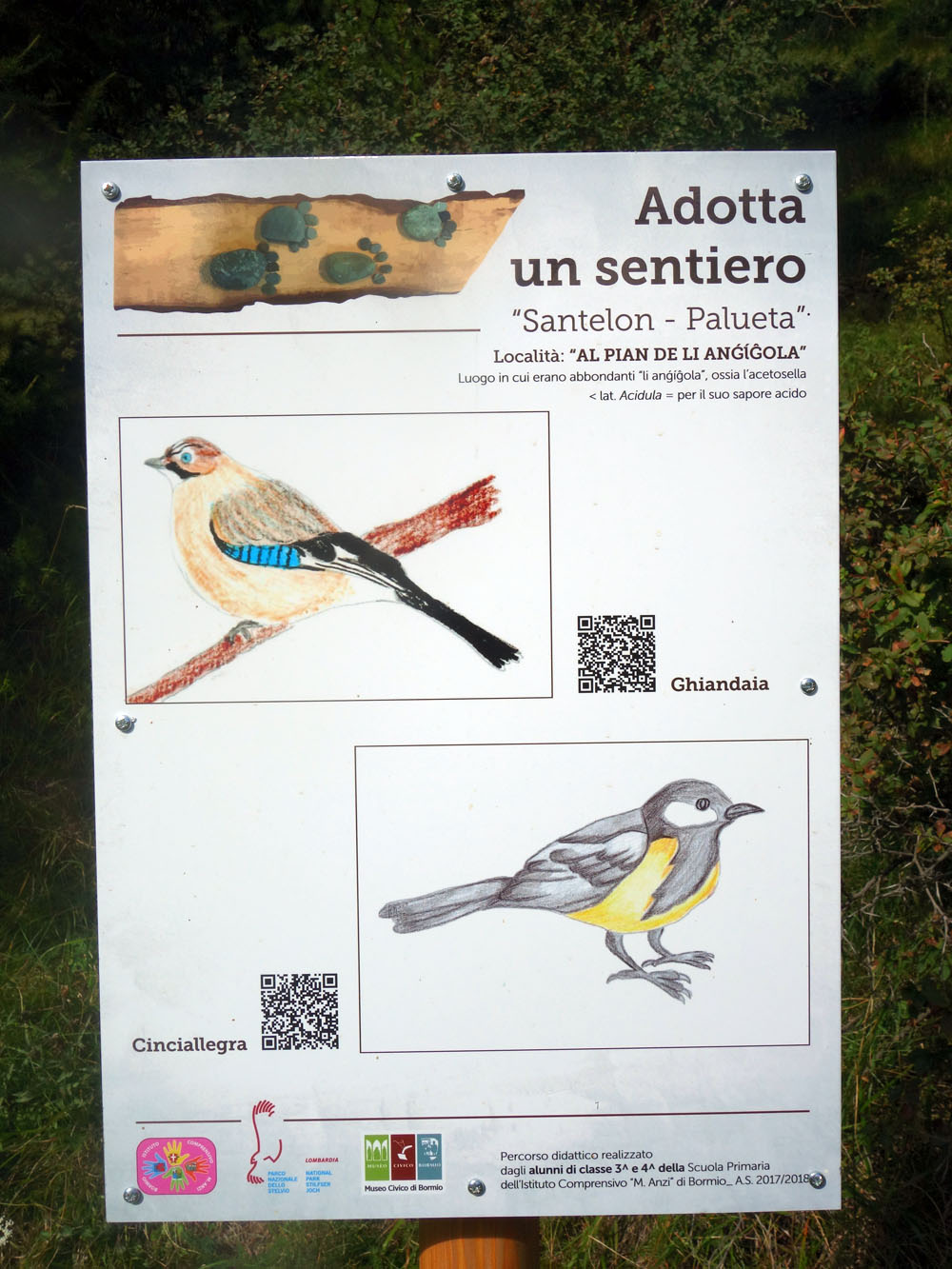
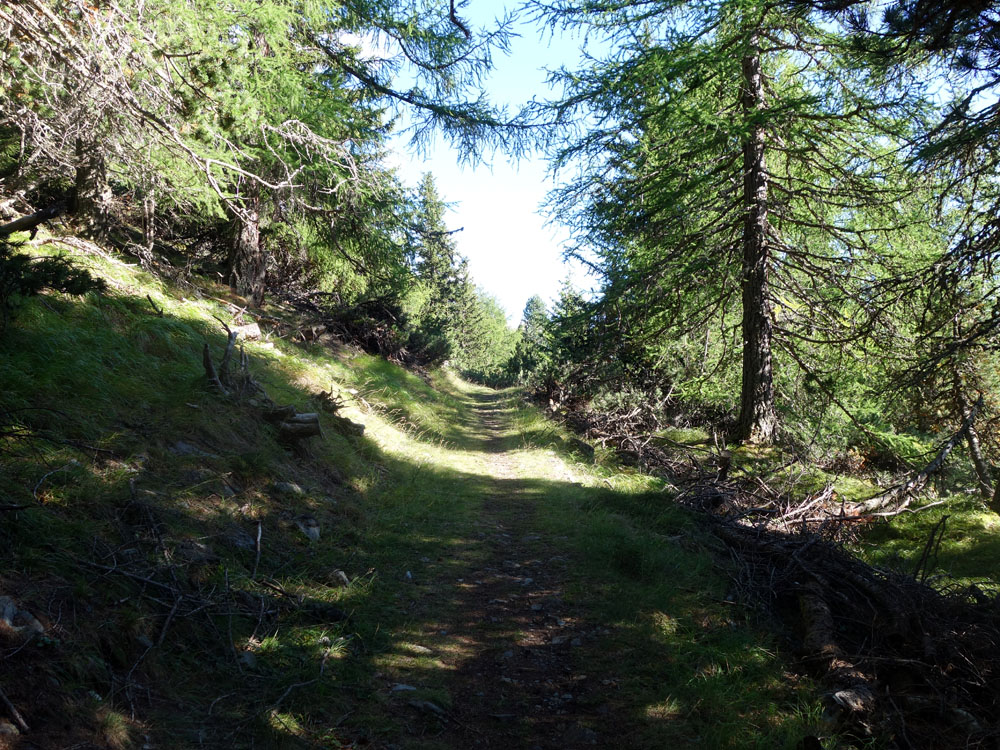
The circular route to the cross of Mount Reit offers a nice hike, in any weather conditions, surrounded by a beautiful larch forest. The uphill road described here contains steep sections, some of which are long. On the other hand, there aren’t significant difficulties when you are going downhill. Along the uphill track, between “Santelon” and “Paluetta”, there are present on the track some marker totems and simple information panels made by the elementary school children of Bormio, in collaboration with the Stelvio National Park and the Museum of Bormio.
Starting from Albergo Adele, walk down along Monte Braulio street until you see San Francesco street on your left. Go up San Francesco street and, at the second fork in the road, stay left on Santellone street. When you reach the end of Santellone street (there is a little chapel) continue straight, always uphill, along the stone road in the direction of the ruin of the “Gesa Rota”.
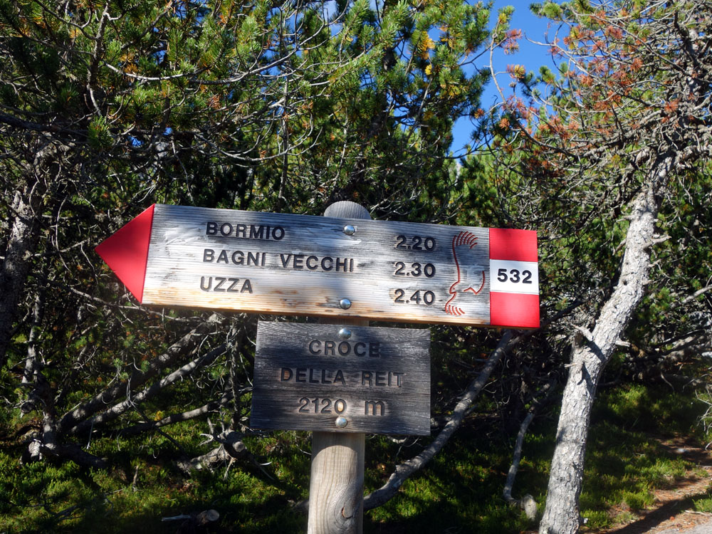
After arriving at the first ruins, near the black electric pylon, take trail 511 in the direction of Pramezzano (there is a sign). Once you reach the “Baite (Alpine houses) of Pramezzano” you will meet the mule track that connects the village of “Uzza” with the “Pedemontana of Mount Reit”.
Take the stone road uphill, following the cultural trail totems, along route 511 in the direction of “Canareglia”. At the next crossroad, where the trail meets the Pedemontana of Mount Reit, don’t turn left but proceed straight along track 511. When you reach the field with a big wooden manger, leave route 511 and go up on the left along the mule track in the direction of “La Casina Alta” (route 532).
Follow the stone road until the field of the Casina Alta (a partially collapsed old wooden building) where, ignoring the signs for track 532, continue straight on the small road that goes through the grass and runs alongside the old mountain cottage, property of the municipality of Bormio. Going past the old building, the route will go up steeply for a few meters until a curve similar to a hairpin turn.
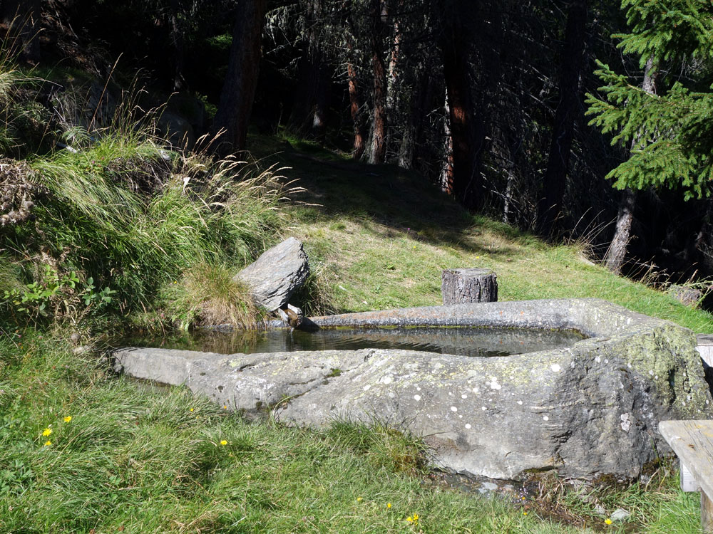
Here you have to turn left. A few meters ahead the mule track becomes a simple trail and, finding route 532 again, you have to continue uphill in the direction of “Paluetta”. Once you reach Paluetta we suggest you take some time to admire the beautiful old stone fountain. The picnic table and a panoramic bench make the break easier, facilitating the contemplation of the incredible panorama and the hard-headed men’s work to hammer out the old drinking trough.
After the break, continue uphill and after about 200 meters, you will arrive at a new crossroad. Here turn left and, leaving track 532, you take the flat trail 532.1 in the direction of “Pravasivo”. This part of the track is called the trail of “Sasc Frasc” and, with a flat and easy path, it leads you to route 532 (west side) that directly connects the Botanical Garden to the Cross of Mount Reit (the downhill route of our excursion).
Along the trail of Sasc Frasc there is a panoramic bench that, like the stone fountain of Paluetta, encourages you to take a contemplation break.
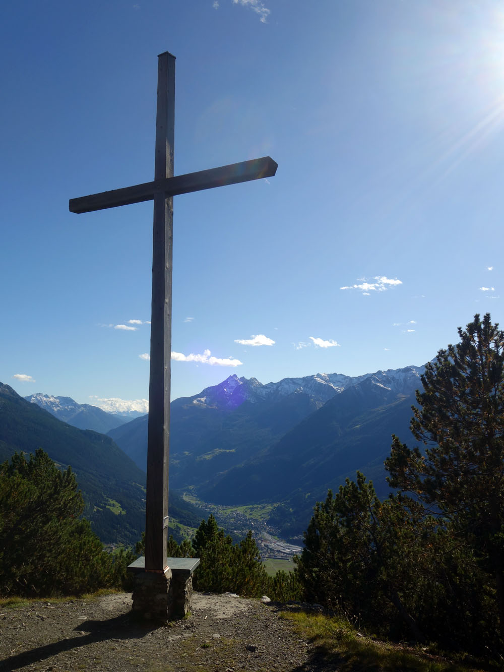
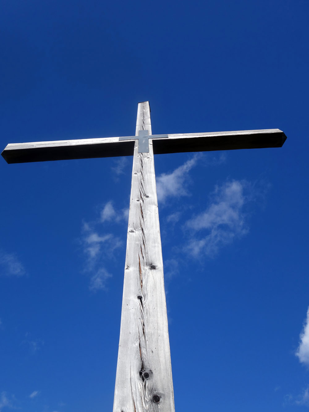
When you reach the intersection with trail 532 (west side) turn right and go uphill and, after an ascent of about 200 meters of difference in altitude, you will arrive at the 2120 meters of the Cross of Reit, the highest point of this excursion.
From the Cross you should go back the way you came until the connection to Sasc Frasc. At the intersection you leave the uphill route and continue, along an easy downhill trail surrounded by a beautiful larch forest, on trail 532 (west side) until you arrive at the mule track Pedemontana of Mount Reit.
Once you reach the Pedemontana of mount Reit turn right and continue downhill along the stone road until the Campello valley and its little river. Here you turn left and go downhill along the trail that runs along the hydrographic left side of the stream, and in a few minutes you will reach the Botanical Garden.
From the Garden you continue straight on the small trail along the river until you reach, some hundreds of meters ahead, the national road of Stelvio. Once you arrive at the national road turn left and follow the street for about 150 meters. At the crossroad, on the left and always going downhill, you take Monte Braulio street and in a couple of minutes you will return to the starting point.
On the route it is possible to see animals like deer, squirrels and a lot of birds such as woodpeckers, the buzzard, the nutcracker, the royal eagle and the bearded vulture.
Cultural points on the route: The gesa rota (church and castle old ruins) – Cultural route: adopt a trail – Stone fountain of Paluetta – Cross of Reit – Botanical Garden – The green stone of Campello valley
Enjoy your walk!
Stefano and all of the Albergo Adele staff
Text translated by Stefano Bedognè and Paul Faller (teacher at MyEnglish Lodi)


COPYRIGHT AND LEGAL POLICIES – UPDATED Mar. 9th 2021
All contents of this blog (text, graphic elements, images, pictures, videos, etc.) are exclusive property of Stefano Bedognè and Albergo Adele s.a.s. and they are protected by Italian and International copyright laws. Therefore only viewing is allowed. Copying, either partial or total, will be allowed only after explicit request and authorization. In this case it must be indicated on the copy the source: www.albergoadele.it. Any other use (distribution or publication for profit, modification, processing in any way or form, etc.) will be considered unauthorized and will be prosecuted by law.
The information provided on this page, on our website and on the blog in general, are finalized to promote the touristic and cultural opportunities of Bormio and Valtellina but they are not substitutions in any way for professional accompaniment or the direct consultation of professional workers.
All of the excursions described on this website are for the purposes of promoting Bormio and Alta Valtellina. Every hiker has to consider independently their physical condition, personal experience and ability. The hiker has to check independently the trail complexity based on personal conditions, trail conditions and weather conditions, including the presence of ice, snow, landslides, avalanches or other events. Albergo Adele and Stefano Bedognè don’t assume any responsibility for any accident occuring to the trekkers during the trip here described. Albergo Adele and Stefano Bedognè always suggest being accompanied by a Mountain Guide.
