
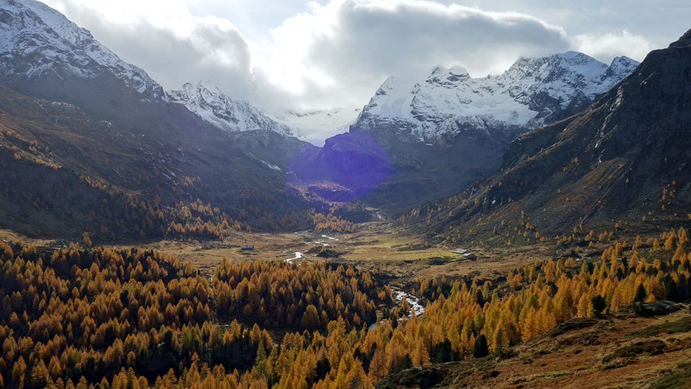
Long, panoramic and of medium difficulty, the excursion to the Val Viola Pass and “Lagh da Val Viola” is a very satisfying transborder hike.
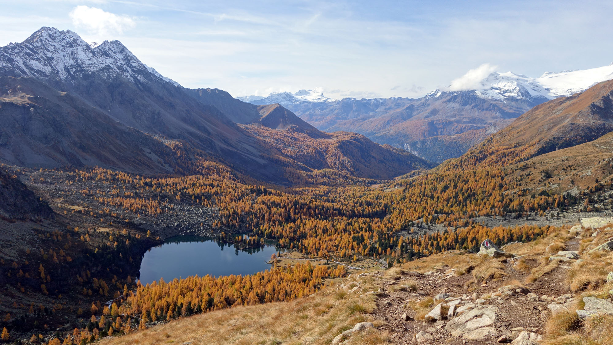
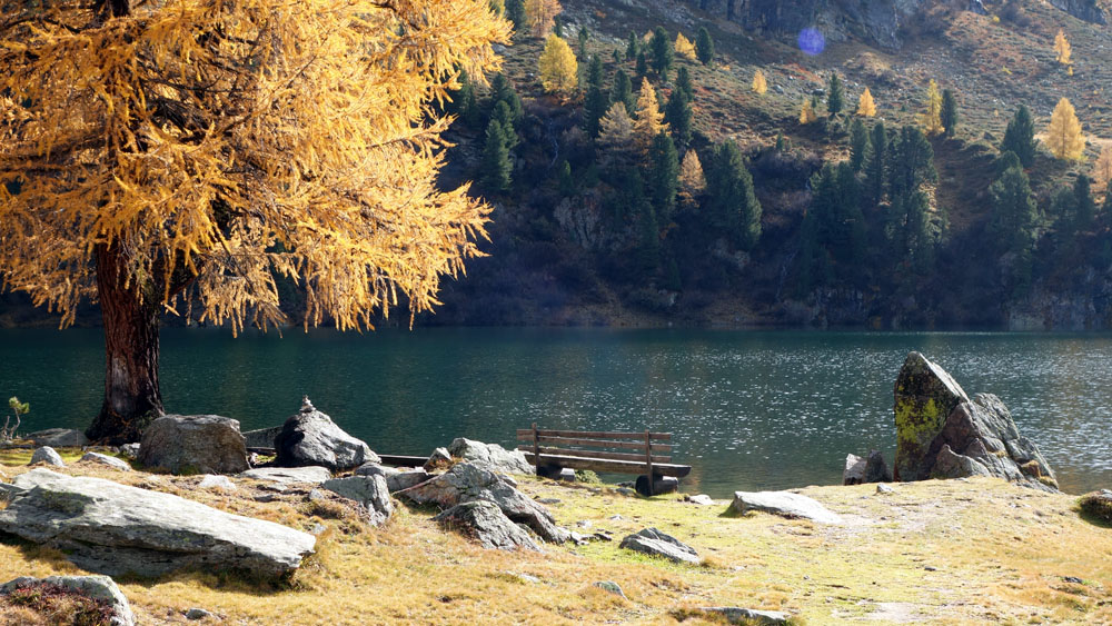
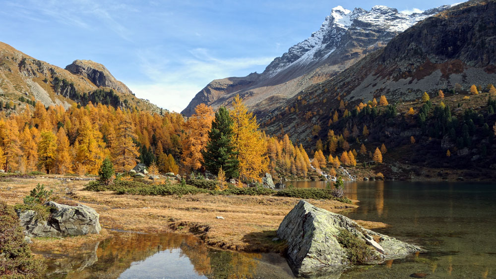
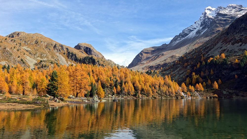
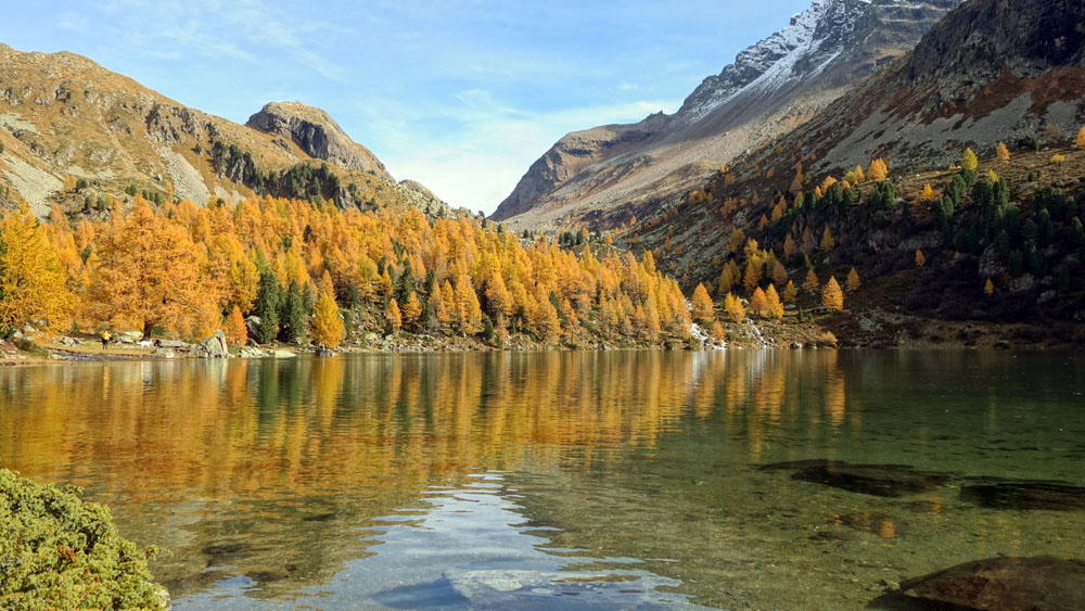
This excursion is made unique by the magnificent small lakes that you meet along the route, like the “Lagh da Val Viola” in the Swiss Val di Campo, one of the most admired and photographed small lakes in the Alps.
Excursion to the Val Viola Pass and “Lagh da Val Viola” in Campo Valley (CH)
Total length of excursion: 17220 meters
Total uphill difference in height: 760 meters
Approximate total time needed for the excursion: 7 hours
Difficulty: easy (4 out of 10)
Recommended season: from the middle of June to the middle of October
Suitable for rainy days? no
General characteristics of the natural environment: very satisfying panoramic trail with glaciers and alpine lakes
Presence of water\fountains on the excursion: yes
Trip on the borders of the Stelvio National Park: no
Benches on the route: yes
Picnic areas on the route: no
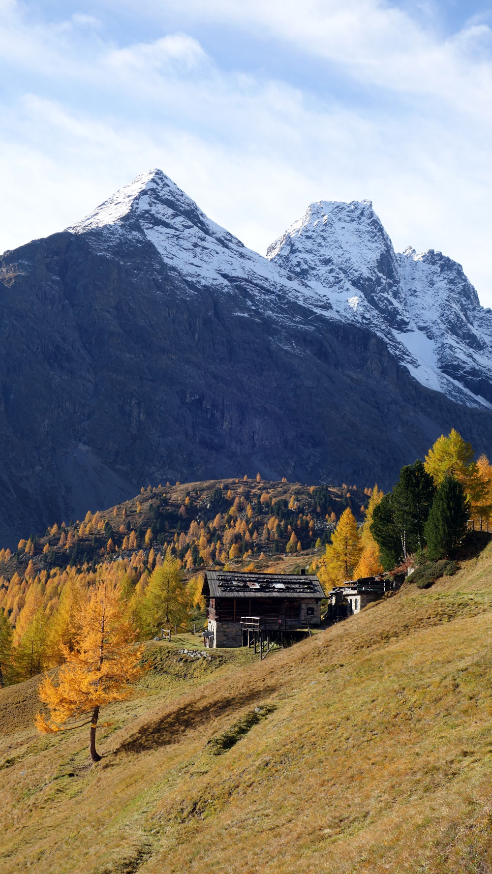
Alpine shelters, bars or restaurants along the route: yes (Rifugio Viola)
Circular route: no
Back and forth route: yes
Pushchair accessible: no
Excursion starting point: Altumeira – Val Viola (Car park with payment required on access road)
Geographic coordinates of the starting point: 46°26’18.56” N – 10°11’55.85” E —- UTM: 32T 592093 – 5143468
Altitude of the starting point: 2070 meters asl Maximum height reached on the excursion: 2461 meters asl
Description of the excursion
Long, panoramic and of medium difficulty, the excursion to the Val Viola pass and “Lagh da Val Viola” is a very satisfying transborder hike. This excursion is made unique by the magnificent small lakes that you meet along the route, like the “Lagh da Val Viola” in the Swiss Val di Campo, one of the most admired and photographed small lakes in the Alps.
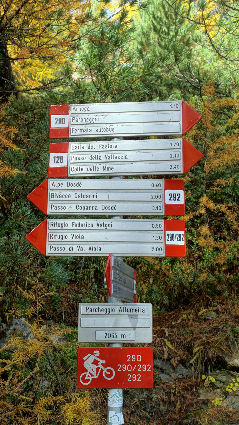
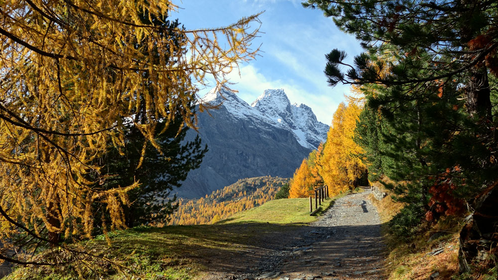
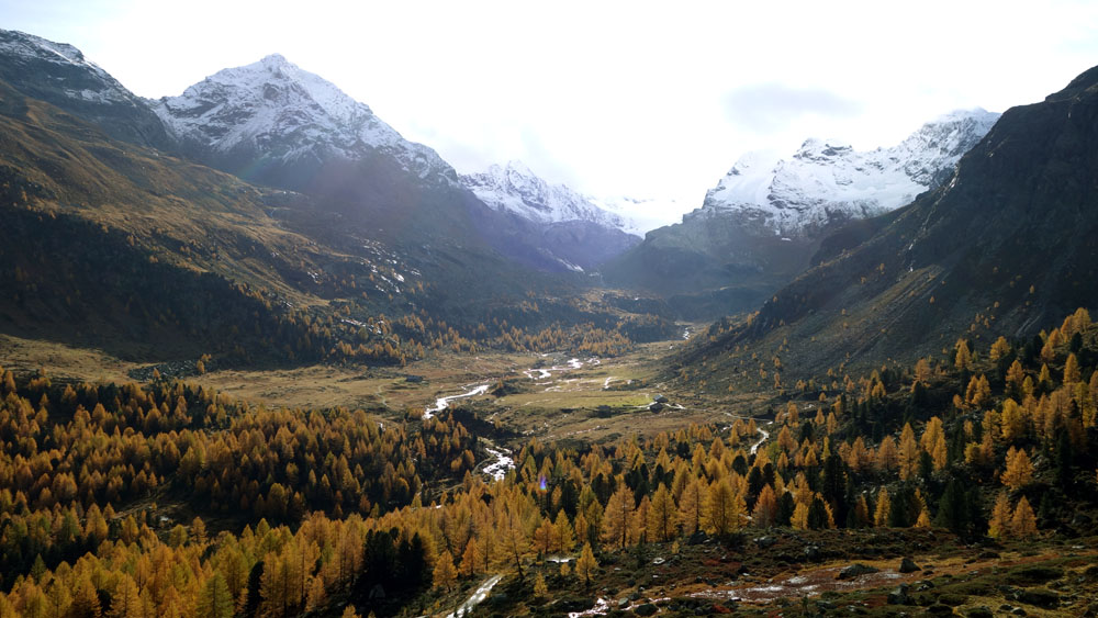
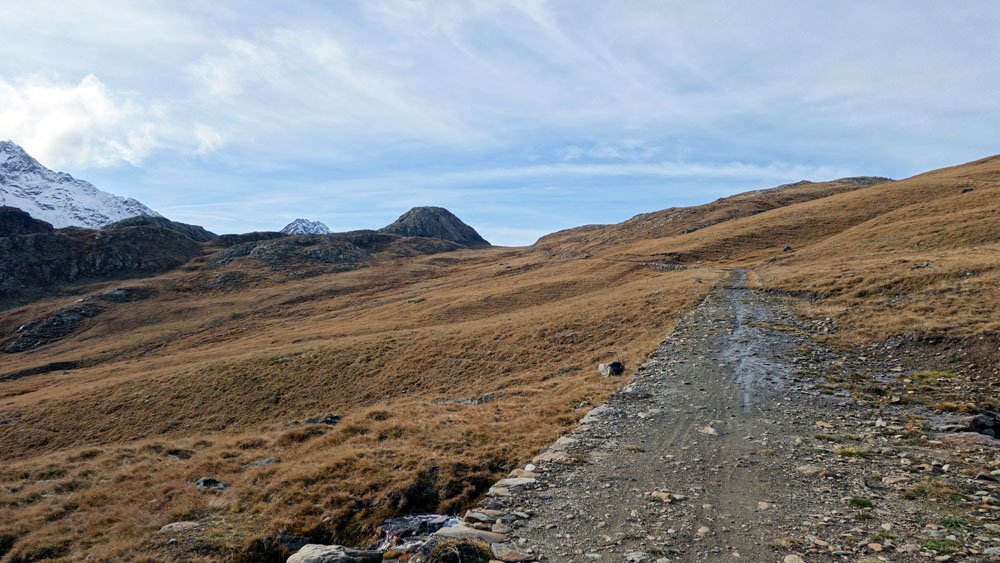
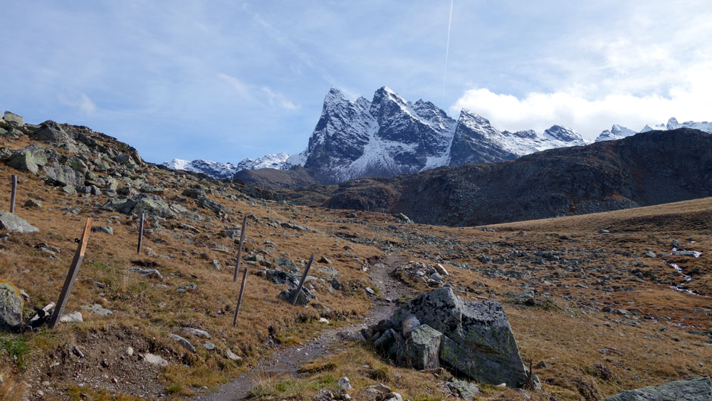
This excursion starts from the car park of “Altumeira” in Val Viola, in the municipality of Valdidentro. From the car park go uphill along the easy stone road of “Val Viola” that, with a slight slope, runs along route 290 in the direction of “Rifugio Viola” and “Passo di Val Viola”.
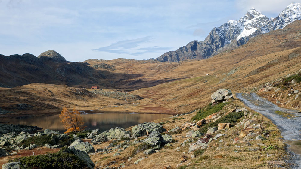
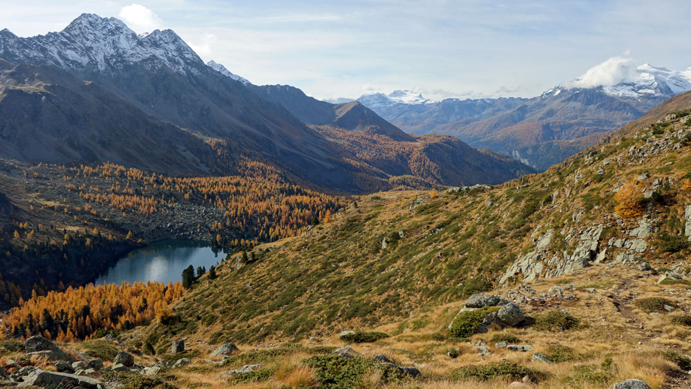
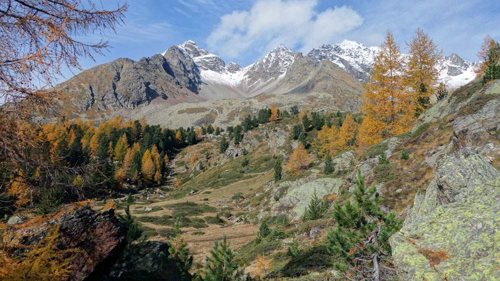
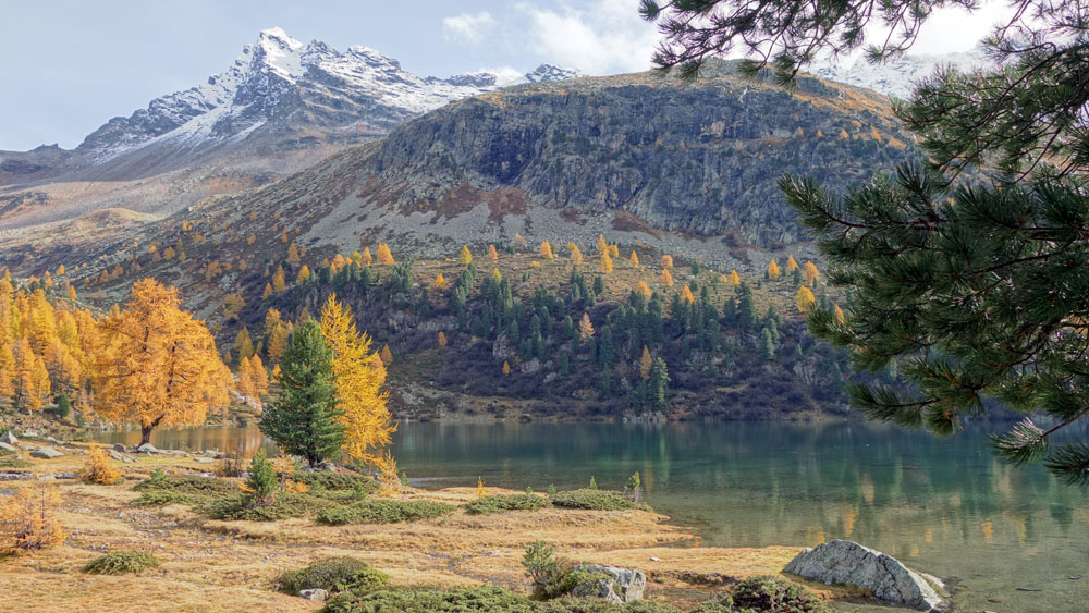
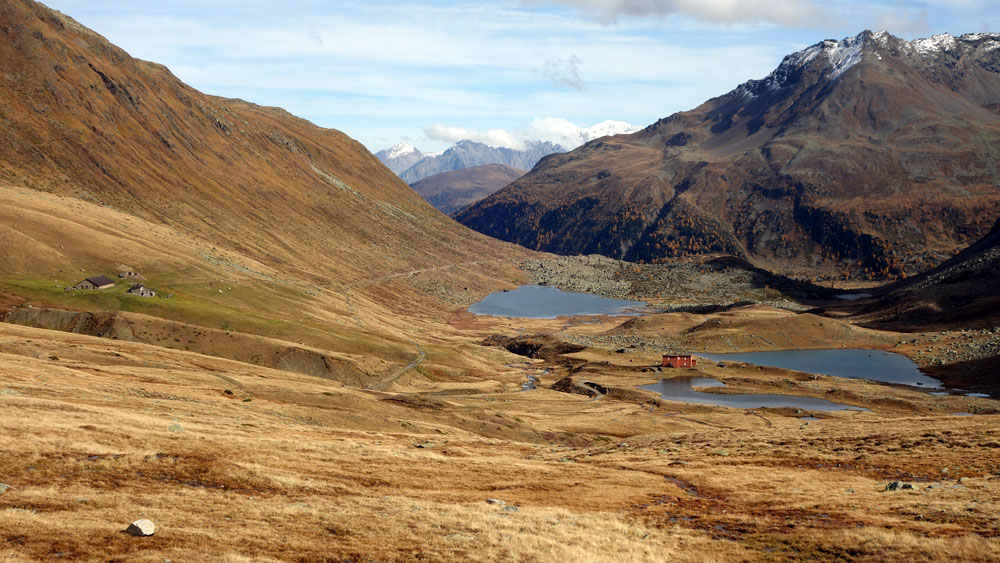
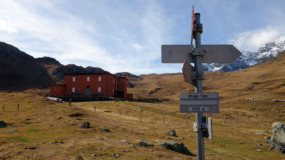
After about 2 kilometres you will arrive in proximity of the “Lago Viola”, the biggest lake on the Italian ridge of the valley. Here the road becomes flat and in a few minutes brings you to the “Rifugio Viola”. A few dozen meters before the Alpine shelter you have to turn right and, staying on the stone road, you continue your ascent in the direction of the “Passo di Val Viola”. From this point the next road signs will be the Swiss ones.
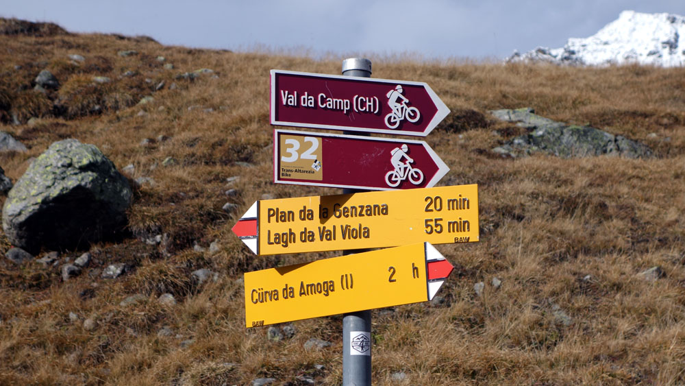
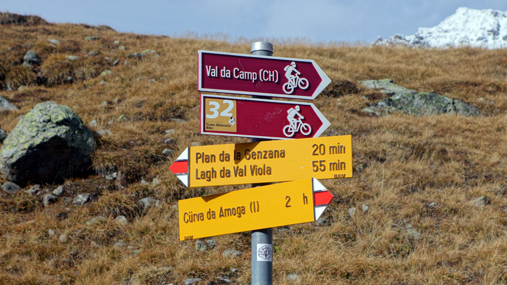
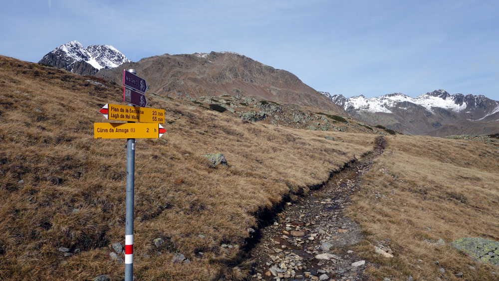
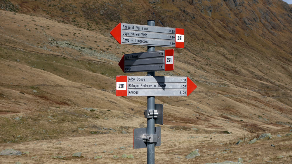
A few dozen meters before reaching the evident Val Viola Pass you meet an intersection that turns right in the direction of the “Val di Camp” (CH) and “Trans Altarezia 32”. Take this track and completely ignore the road signs and the stone road that invite you to go straight in the direction of the Lagh da Val Viola and Plan de la Genzana. (pay attention at the intersection).
This alternative road, longer and just a bit less panoramic, is convenient because it’s easier and less dangerous. Speaking of which, we remind you that in Switzerland all rescues are to be paid for.
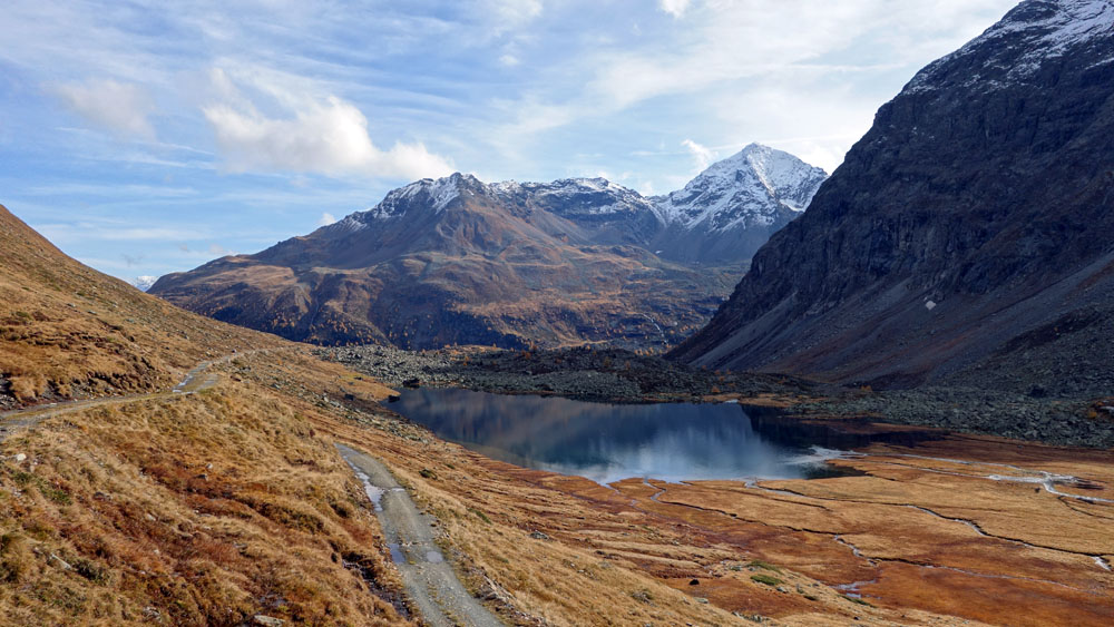
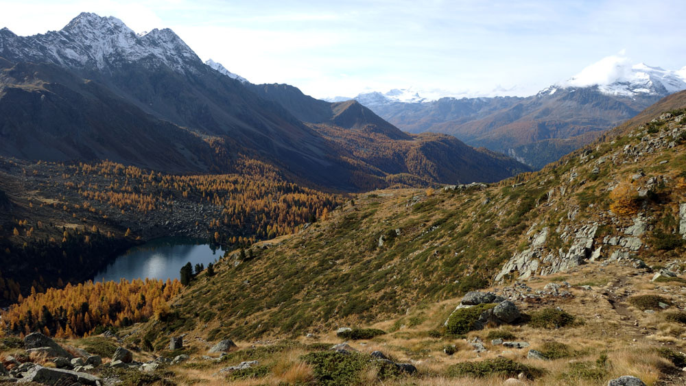
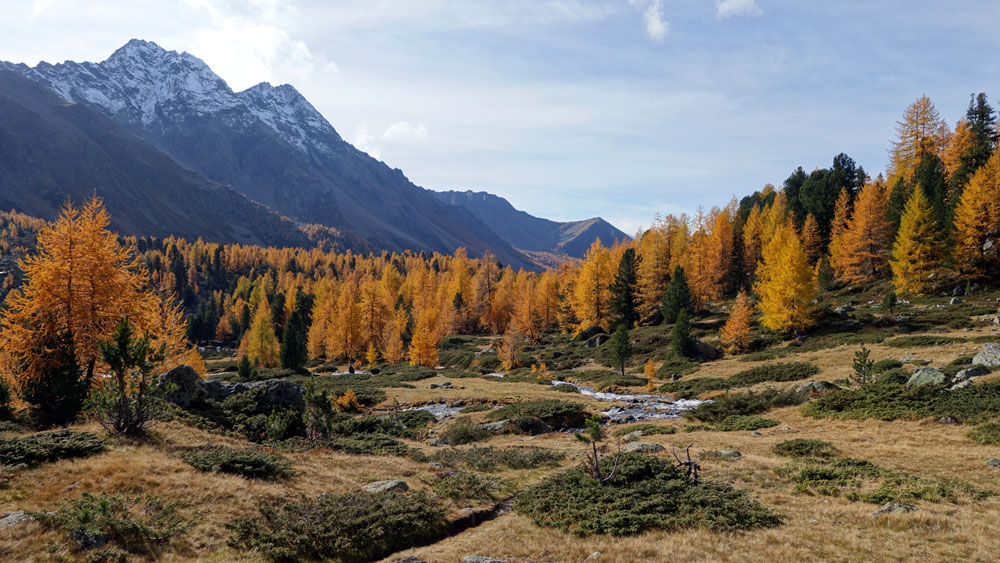
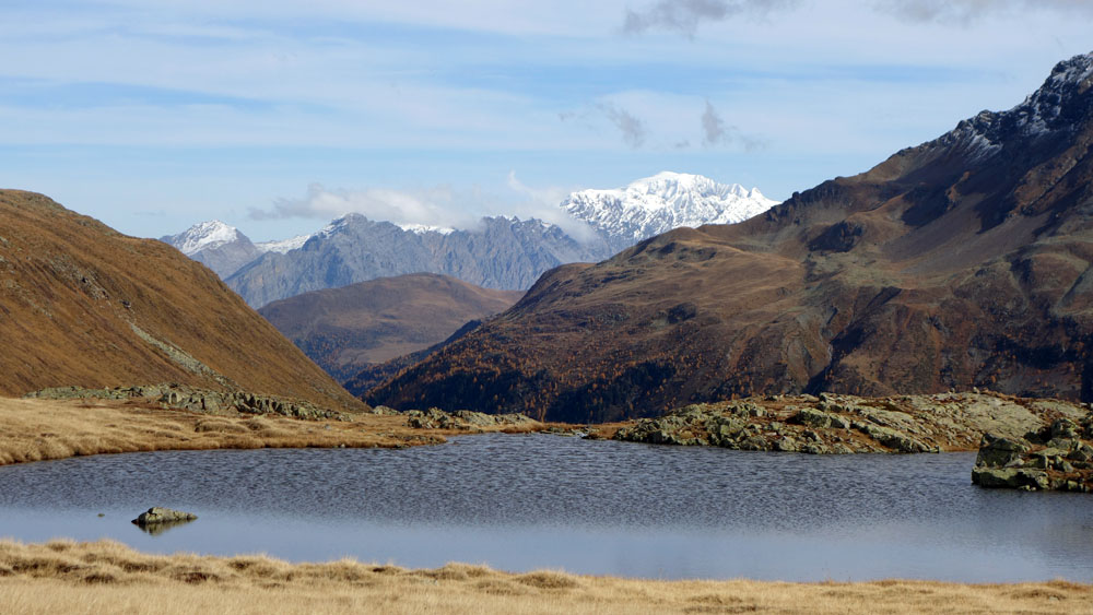
Crossing the country border between Italy and Switzerland the route goes slightly downhill surrounded by beautiful high mountain meadows. After about 3 kilometres you will arrive at the incredible “Lagh da Val Viola”, a jewel nestled between rugged mountains and luxuriant vegetation dominated by impressive larches. Around the lake many benches invite you to take a break to enjoy the serenity of the place and the pleasure of good living.
After the break and the typical photos, go back the way you came paying attention to the road signs in the direction of the Passo di Val Viola that invite you to follow a different route. Ignore them and only go back via your original route.
Trivia: In the Bormio area, the Lagh da Val Viola is usually called Lago Saoseo.
Enjoy your walk!
Stefano and all of the Albergo Adele staff
Text translated by Stefano Bedognè and Paul Faller (teacher at MyEnglish Lodi)


COPYRIGHT AND LEGAL POLICIES – UPDATED Mar. 9th 2021
All contents of this blog (text, graphic elements, images, pictures, videos, etc.) are exclusive property of Stefano Bedognè and Albergo Adele s.a.s. and they are protected by Italian and International copyright laws. Therefore only viewing is allowed. Copying, either partial or total, will be allowed only after explicit request and authorization. In this case it must be indicated on the copy the source: www.albergoadele.it. Any other use (distribution or publication for profit, modification, processing in any way or form, etc.) will be considered unauthorized and will be prosecuted by law.
The information provided on this page, on our website and on the blog in general, are finalized to promote the touristic and cultural opportunities of Bormio and Valtellina but they are not substitutions in any way for professional accompaniment or the direct consultation of professional workers.
All of the excursions described on this website are for the purposes of promoting Bormio and Alta Valtellina. Every hiker has to consider independently their physical condition, personal experience and ability. The hiker has to check independently the trail complexity based on personal conditions, trail conditions and weather conditions, including the presence of ice, snow, landslides, avalanches or other events. Albergo Adele and Stefano Bedognè don’t assume any responsibility for any accident occuring to the trekkers during the trip here described. Albergo Adele and Stefano Bedognè always suggest being accompanied by a Mountain Guide.
