

Excursion of Mount Scale – circular route
Total length of excursion: 7600 meters
Total uphill difference in height: 560 meters
Approximate total time needed for the excursion: 4 hours
Difficulty: hard (8 out of 10)
Recommended season: from the middle of June to the first days of October
Suitable for rainy days? No
General characteristics of the natural environment: Pinus mugo wood (mountain pine), screes and high mountains
Presence of water\fountains on the excursion: no
Trip on the borders of the Stelvio National Park: yes
Benches on the route: yes
Picnic areas on the route: yes
Alpine shelters, bars or restaurants along the route: no
Circular route: yes
Back and forth route: no
Pushchair accessible: no
Excursion starting point: Towers of Fraele (Torri di Fraele)
Geographic coordinates of the starting point: 46°30’09.80” N – 10°18’39.35” E —- UTM: 32T 600585 – 5150741
Altitude of the starting point: 1935 meters asl Maximum height reached on the excursion: 2495 meters asl
Description of the excursion: Circular route of Mount Scale
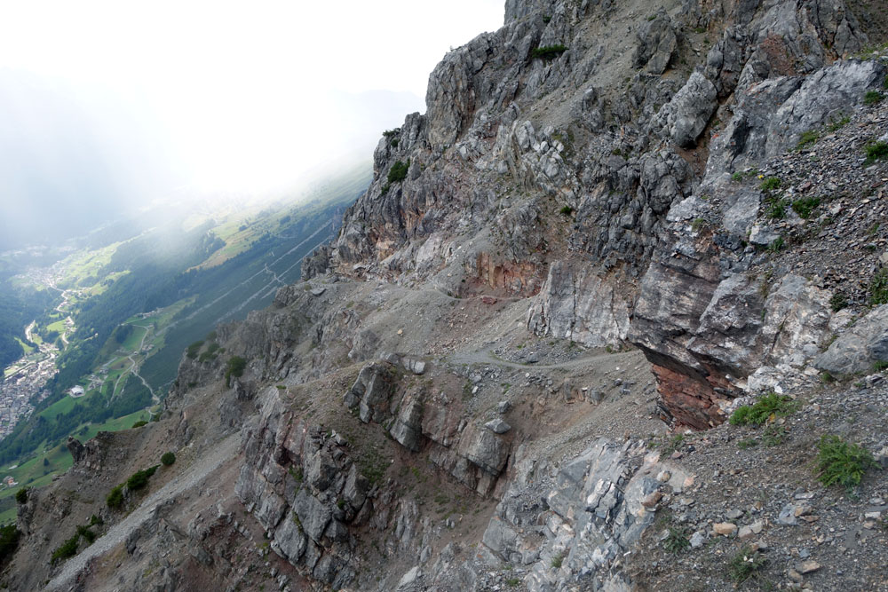
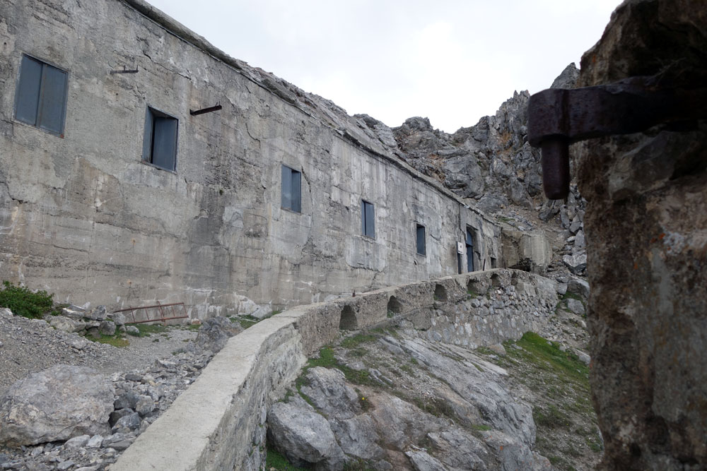
The circular route of Mount Scale is a very satisfying excursion. Without specific mountain climbing equipment and with limited technical skills, it is possible to reach the top of one of the most panoramic peaks of the Alta Valtellina area. On top of the unbelievable majesty of the panorama there is also the intelligence of man-made construction, with an incredible mule track and the summit tunnel, which are military constructions built for the first world war.
The excursion has limited and short technical\delicate steps (a few dozen meters in total). This trip also has a strong exposition along the uphill side.
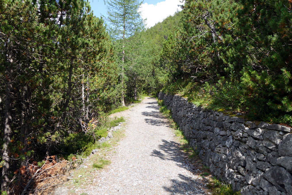
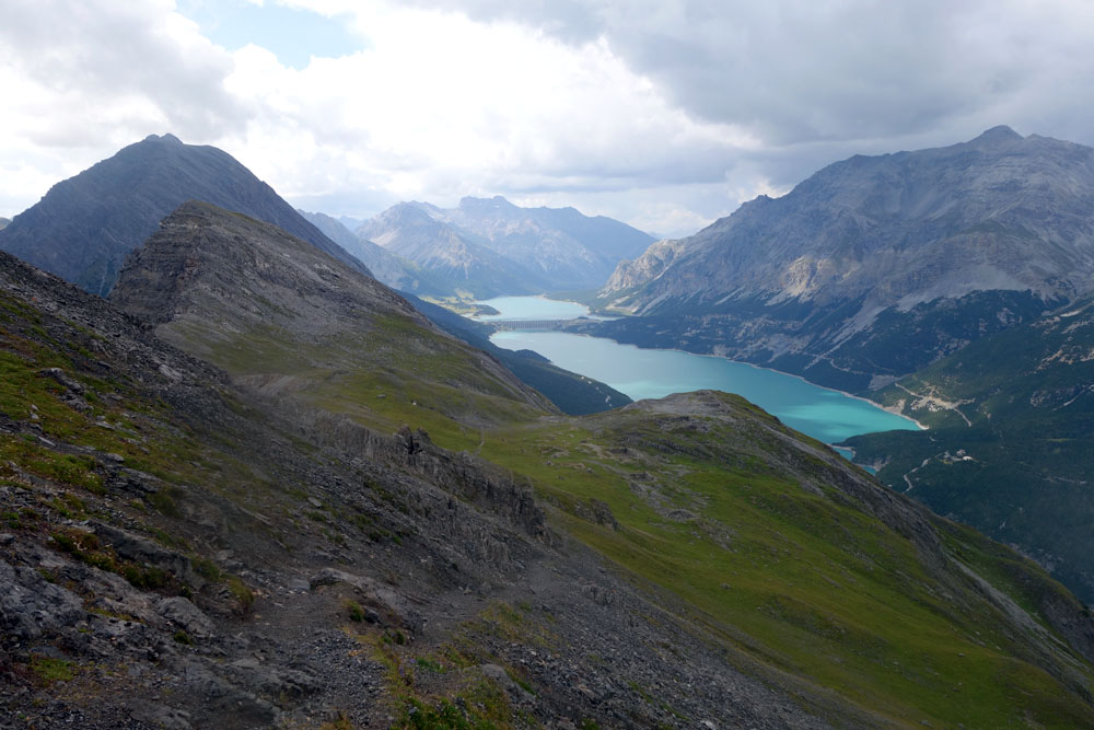
Near the first car park after the tower of Fraele you take the mule track that, on the right-hand side goes up in the direction of Mount Scale (Monte Scale). The road ascends with a soft slope, interrupted by striking hairpin bends, along the mountain’s west ridge, until you reach the edge of the wood and the rocks of the west peak. Here the road becomes narrower and it turns onto the south face of the mountain. The trail, with strong exposition, continues gently climbing uphill, alternating between narrower tracts and easier ones. The last part of the climb presents short passages equipped with metal cables. Arriving at the small military fort at the summit, where there are panels with historical information, you pass through the tunnel towards the north side of the mountain. There are not too many occasions in life to enjoy such an incredible spectacle. After a few meters surrounded by the darkness of the tunnel, you will find yourself facing a landscape completely different to the other side of the peak. The strong exposition, rocks and screes of the south side give way to the green alpine fields and lovely panoramas of the north side. It’s breathtaking.
From the tunnel exit, turn right and go uphill. In about a dozen minutes you will reach the cross at the summit. Near the mountain top, you will find a compass rose made by the local Alpine Club of Valdidentro, which helps visitors to recognize the peaks of the area. From the top you can go back the way you came until the tunnel. Near the tunnel, turn right and go downhill where you see a track and a sign. Past the sign, the downhill single track will always be clear, but it will be interrupted by 2 shorter technical tracts on broken rocks where it is necessary to pay more attention. After the “technical” passage highlighted by red signs on the rock, the downhill slope becomes easy and pleasant till Lake Scale (lago Scale).
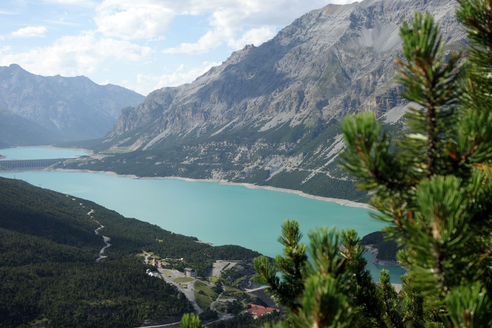
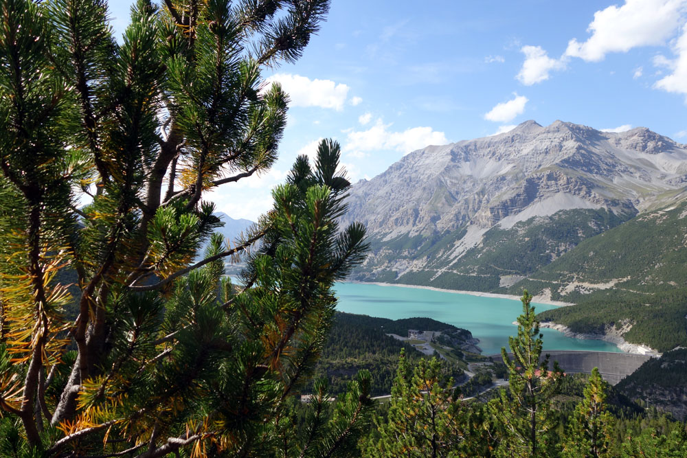
After reaching Lake Scale, you turn left along the main road and, in a thousand meters, you will come back to the starting point.
Historic and cultural points along the route: The towers of Fraele – The small military fort at the top of Mount Scale
Enjoy your walk!
Stefano and all of the Albergo Adele staff


All contents of this blog (text, graphic elements, images, pictures, videos, etc.) are exclusive property of Stefano Bedognè and Albergo Adele s.a.s. and they are protected by Italian and International copyright laws. Therefore only viewing is allowed. Copying, either partial or total, will be allowed only after explicit request and authorization. In this case it must be indicated on the copy the source: www.albergoadele.it . Any other use (distribution or publication for profit, modification, processing in any way or form, etc.) will be considered unauthorized and will be prosecuted by law.
The information provided on this page, on our website and on the blog in general, are finalized to promote the touristic and cultural opportunities of Bormio and Valtellina but they are not substitutions in any way for professional accompaniment or the direct consultation of professional workers.
The authors, although checking with greatest attention all of the contents of this website, also in terms of uptades, don’t take any responsibility for any potential problem that could happen related to misuse use of the site, including information on this website or other related websites. Albergo Adele s.a.s. and Stefano Bedognè, unless otherwise stated by the law, can not be considered in any way responsible for damages, direct or indirect, caused by accessing this website, the inability or impossibility of access, and trusting in the information contained within and by the use of that.
All of the excursions described on this website are for the purposes of promoting Bormio and Alta Valtellina. Every hiker has to consider independently their physical condition, personal experience and ability. The hiker has to check independently the trail complexity based on personal conditions, trail conditions and weather conditions, including the presence of ice, snow, landslides, avalanches or other events. Albergo Adele and Stefano Bedognè don’t assume any responsibility for any accident occuring to the trekkers during the trip here described. Albergo Adele and Stefano Bedognè always suggest being accompanied by a Mountain Guide.
