

I like to describe the circular route of “Fortini del Pian di Pec” as the excursion of abandon. This term has at least two meanings, one practical and one emotional.
Excursion to the small forts of “Pian di Pec”
Total length of excursion: 7500 meters
Total uphill difference in height: 510 meters
Approximate total time needed for the excursion: 4 hours
Difficulty: hard (7 out of 10)
Recommended season: from the end of June to the middle of October
Suitable for rainy days? no
General characteristics of the natural environment: historic and panoramic high mountain trail
Presence of water\fountains on the excursion: no
Trip on the borders of the Stelvio National Park: yes
Benches on the route:no
Picnic areas on the route: no
Alpine shelters, bars or restaurants along the route: no
Circular route: not completely (the starting and finishing point of this excursion are not the same)
Back and forth route: yes (if taking the back and forth route from the “Fortini”, difficulty medium 5 of 10)
Pushchair accessible: no
Excursion starting point: Car park of I° Cantoniera dello Stelvio
Geographic coordinates of the starting point: 46°30’34.39” N – 10°22’22.94” E —- UTM: 32T 605337 – 5151581
Altitude of the starting point: 1720 meters asl Maximum height reached on the excursion: 2250 meters asl
Attention: the starting and finishing point of this excursion are not the same.
Description of the excursion
Introduction
I like to describe the circular route of “Fortini del Pian di Pec” as the excursion of abandon. This term has at least two meanings, one practical and one emotional. The practical meaning is due to the poor maintenance and appreciation given, until the present day, to the wonderful mule track that starting from the hairpin of fortini, just a few hundred meters above the “I° Cantoniera dello Stelvio”, goes up with a regular slope along the mountain ridge. The emotional motivation is instead due to the teaching that this path can offer: the abandonment of the hectic pace of life and the wonder of the unexpected.
Description of the excursion
From the car park of “I ° Cantoniera”, take the state road for about 50 meters towards Passo Stelvio. Left behind the ruin of the road-worker’s house, there is a grassy clearing on the right.
At the end of the meadow, near a road sign, the path goes uphill into the mountain pine forest. This initial stretch, once called “scurtirol de la prima” (shortcut of the I° Cantoniera), quickly leads to the hairpin bend of the forts (n °29) where the mule track to the forts of the “pian di pec” begins.
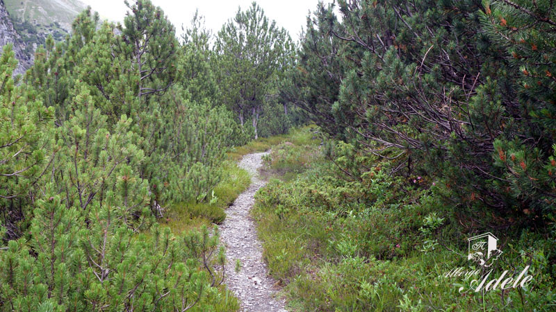
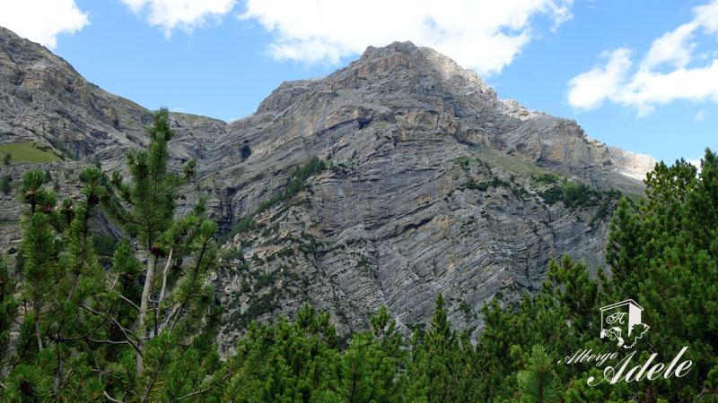
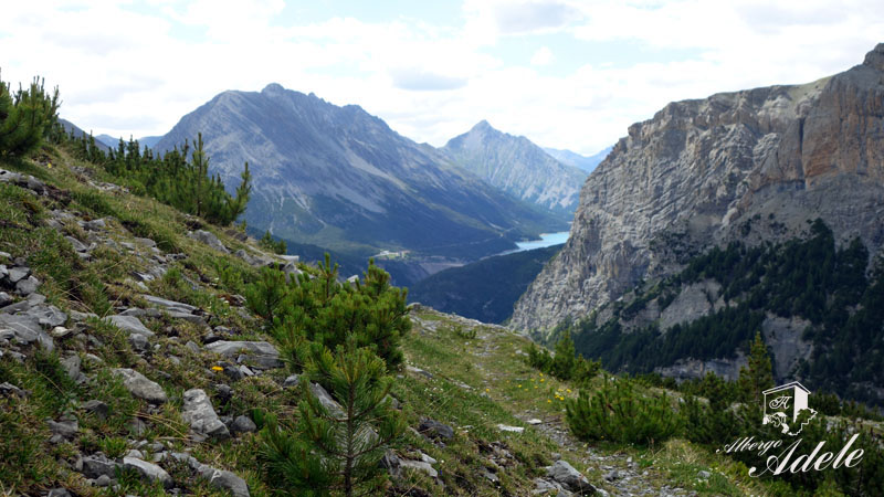
Surrounded by a dense mountain pine forest, the historic military road climbs with a regular slope along the ridge of the “Pian di Pec”. The whole climb is accompanied by the majestic presence of the walls of Pedenolo and Monte Radisca.
These imposing and apparently inviolable rocky crags, interspersed with spectacular grassy ledges (field of flowers), offer hikers the rare opportunity to observe a mountain from this unusual angle. Along the way, the initial sense of oppression gradually becomes lighter until it gives way to new emotions such as amazement and wonder.
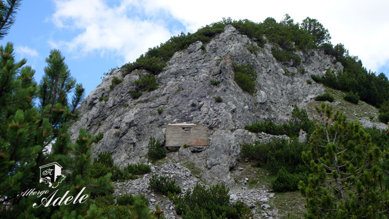
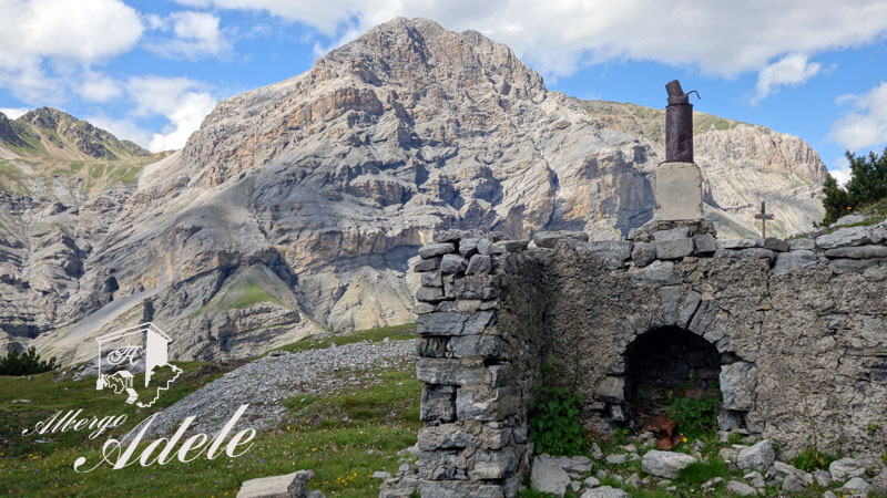
Having reached the first ruins dating back to the White War (most evidently a concrete structure perched on a rocky spur), the mule track has a short slightly downhill section. A few dozen meters further on, after having crossed a small rocky strip perpendicular to the path, the track turns decisively to the left. A short and steep climb leads in a few minutes to the ruins of the military forts.
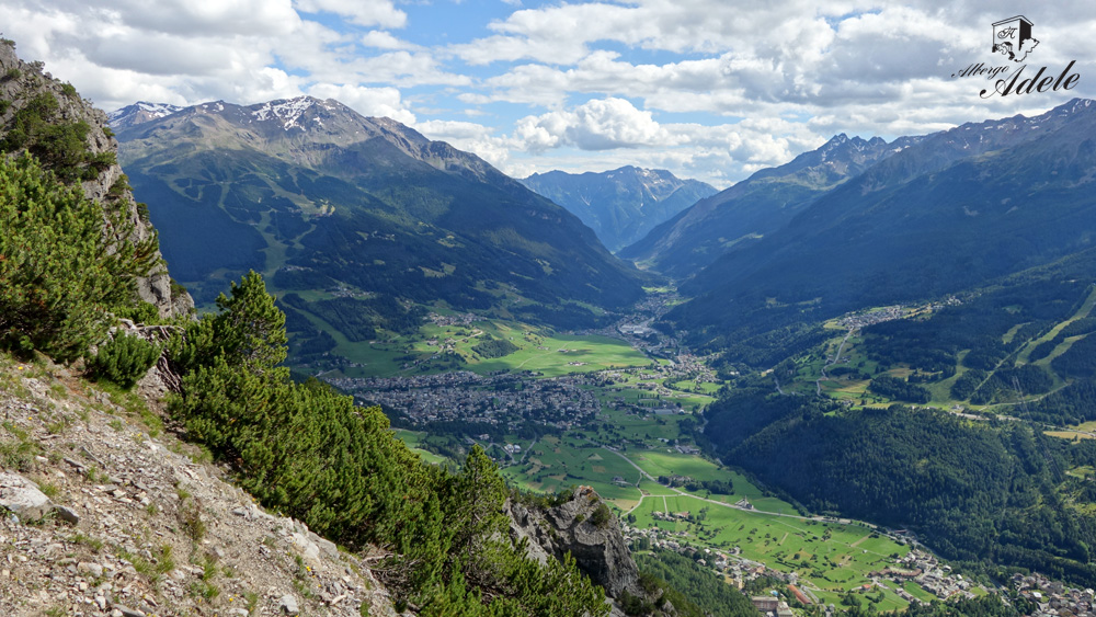
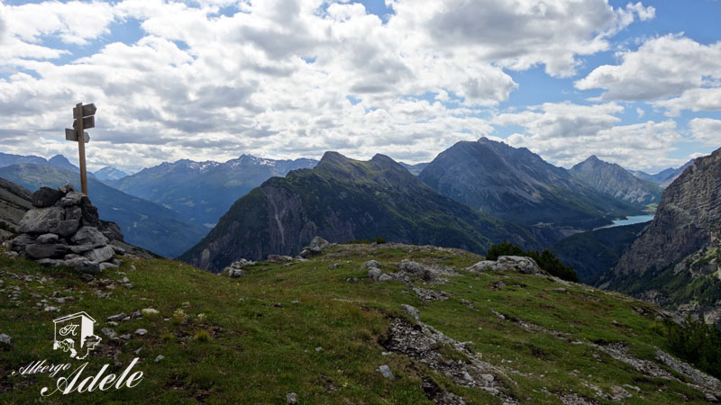
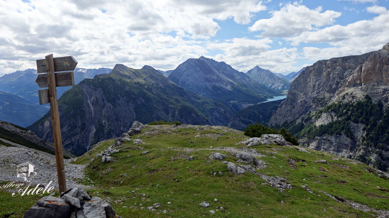
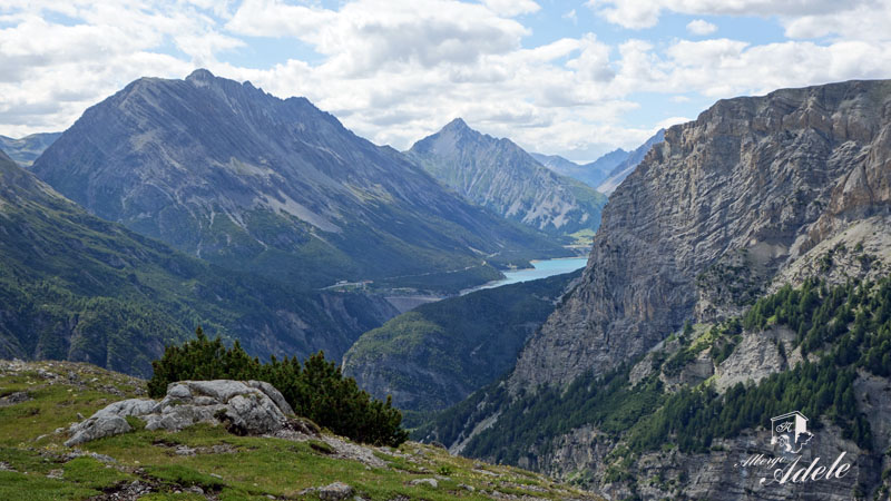
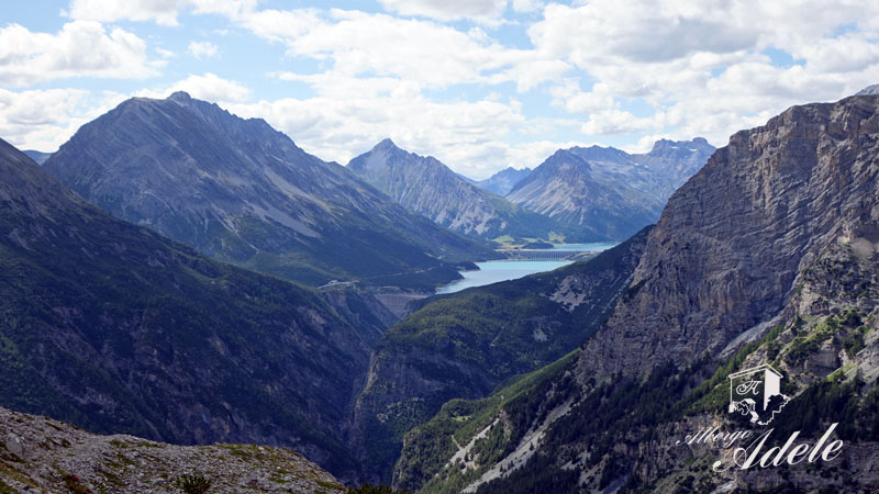
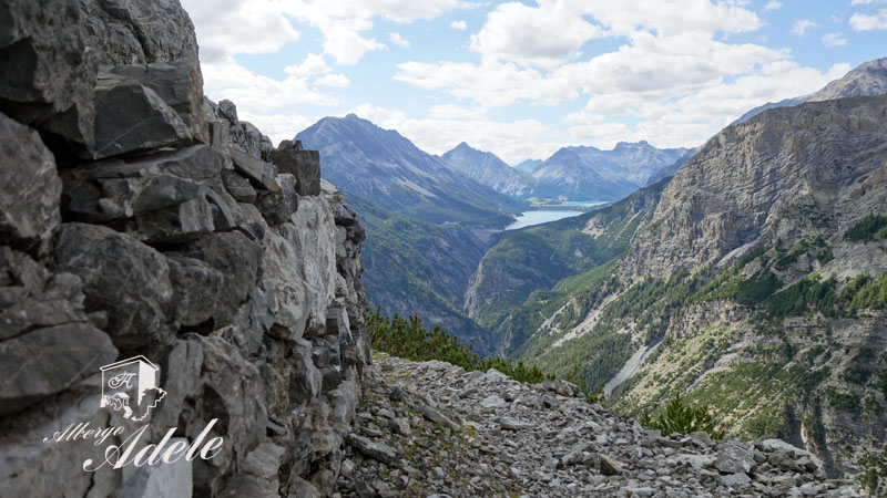
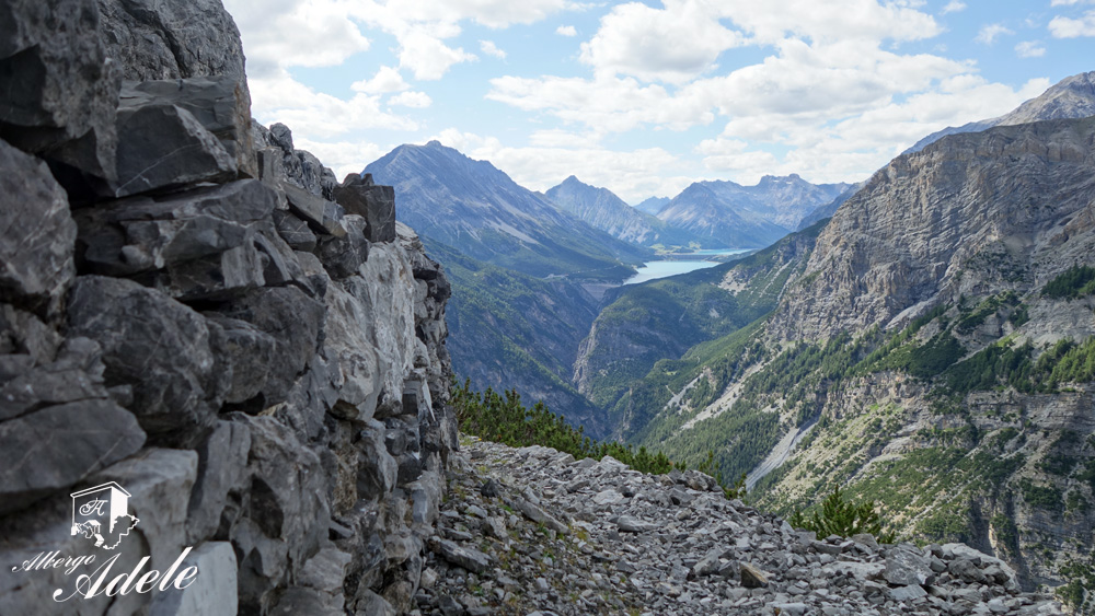
The incredible meadow area you have just reached, occupied during the First World War by Alpine artillery guns to protect the “Filon del Mot” and “Rese Alte di Scorluzzo” lines, offers a spectacular view of the mountains of the upper Braulio valley. Towards the west, your gaze will be captured by the Cancano lakes, Monte Scale and the Cime di Plator. The view over the Valdidentro, the Val Viola and the icy white walls of the Bernina peaks in the background is also precious.
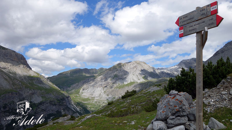
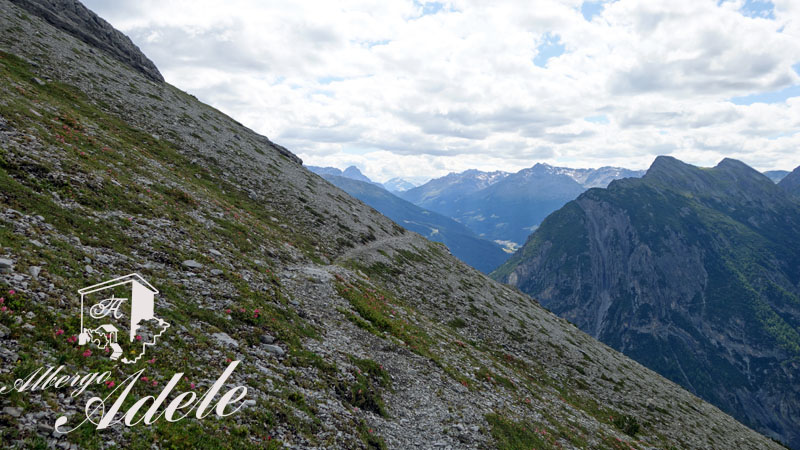
Leaving the area once occupied by the forts, take path 505 in the direction of the “tre baracche”. The initially flat path heads west towards Valdidentro.
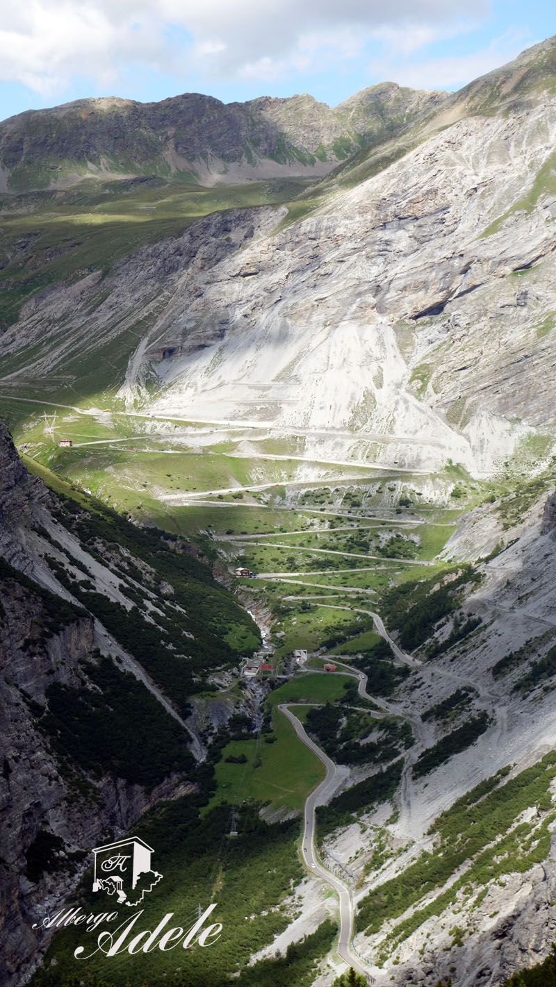
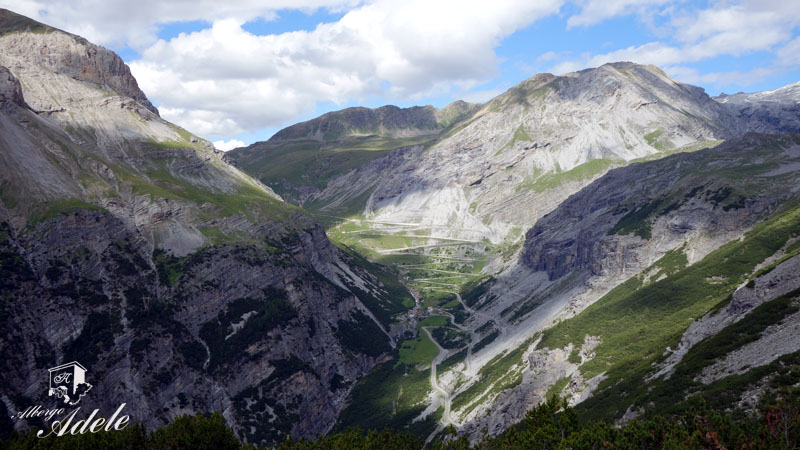
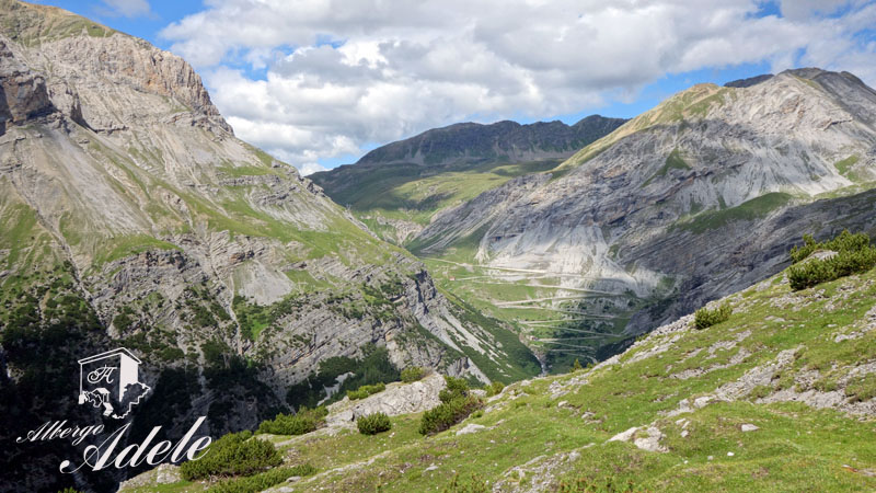
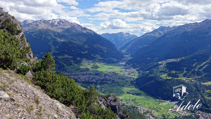
From here on, the route is always well marked and evident, however, near a rocky strip, there is the most technically difficult point of the entire route. A section of about 50 meters with a steep descent on compact gravel. After that short section, the path continues downhill. In a few minutes you can reach one of the most beautiful panoramic balconies of the whole Valtellina with a spectacular view of the Bormio basin.
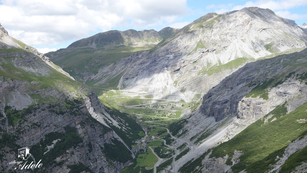
From there on, the route continues downhill, with some particularly steep sections, up to the “tre baracche” locality.
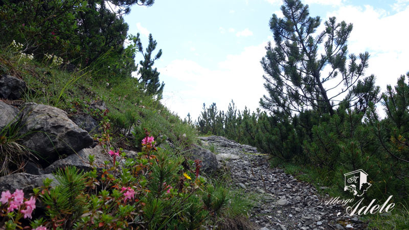
Along the way it is possible to spot chamois, ibex, eagles and bearded vultures. Of particular value is the rich alpine flora with rhododendrons, edelweiss, chrysanthemums, willows, dwarf willows and much more.
Enjoy your walk!
Notes
The departure and arrival points of this excursion are different. From the “tre baracche” it is possible to close the ring by following the Stelvio road uphill for about 1500 meters. Alternatively, I suggest leaving the car in the “3 baracche” parking area and taking the bus uphill to the hairpin bend of the Fortini. (check in advance the timetable and services of the Bus line).
Cultural points along the route: The sites of the White War


COPYRIGHT AND LEGAL POLICIES – UPDATED Mar. 9th 2021
All contents of this blog (text, graphic elements, images, pictures, videos, etc.) are exclusive property of Stefano Bedognè and Albergo Adele s.a.s. and they are protected by Italian and International copyright laws. Therefore only viewing is allowed. Copying, either partial or total, will be allowed only after explicit request and authorization. In this case it must be indicated on the copy the source: www.albergoadele.it. Any other use (distribution or publication for profit, modification, processing in any way or form, etc.) will be considered unauthorized and will be prosecuted by law.
The information provided on this page, on our website and on the blog in general, are finalized to promote the touristic and cultural opportunities of Bormio and Valtellina but they are not substitutions in any way for professional accompaniment or the direct consultation of professional workers.
All of the excursions described on this website are for the purposes of promoting Bormio and Alta Valtellina. Every hiker has to consider independently their physical condition, personal experience and ability. The hiker has to check independently the trail complexity based on personal conditions, trail conditions and weather conditions, including the presence of ice, snow, landslides, avalanches or other events. Albergo Adele and Stefano Bedognè don’t assume any responsibility for any accident occuring to the trekkers during the trip here described. Albergo Adele and Stefano Bedognè always suggest being accompanied by a Mountain Guide.
