
Excursion to Lake Mot – Valle dei vitelli
lake mot
Total length of excursion: 6300 meters
Total uphill difference in height: 345 meters
Approximate total time needed for the excursion: 2 hours and 30 minutes
Difficulty: medium (5 out of 10) on the back and forth route. Hard (7 out of 10) on the circular route
Recommended season: from the middle of June to the first days of October
Suitable for rainy days? no
General characteristics of the natural environment: high mountain meadow and glacier valley
Presence of water\fountains on the excursion: yes
Trip on the borders of the Stelvio National Park: yes
Benches on the route: no
Picnic areas on the route: no
Alpine shelters, bars or restaurants along the route: no
Circular route: yes (difficulty 7 out of 10)
Back and forth route: yes (difficulty 5 out of 10)
Pushchair accessible: no
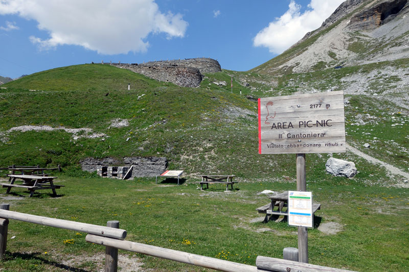
Excursion starting point: Picnic area near the II Cantoniera of Stelvio
Geographic coordinates of the starting point: 46°31’07” N – 10°24’07” E —- UTM: 32T 607973 – 5152636
Altitude of the starting point: 2177 meters asl Maximum height reached on the excursion: 2470 meters asl
Description of the excursion
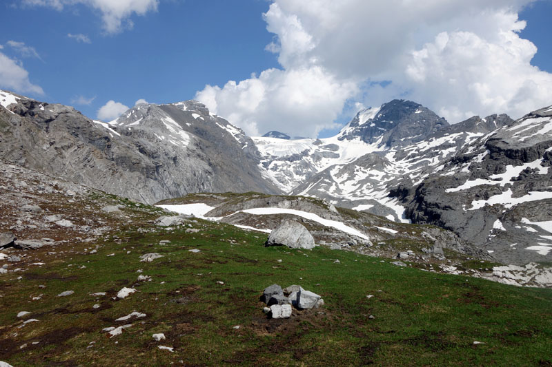
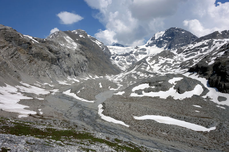
The excursion to Lake Mot is one of the marvels of the Braulio Valley. The route, on single track that is not always well marked, is also suitable for a half day excursion in a majestic environment.
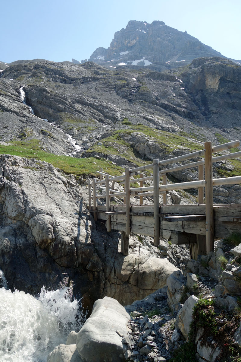
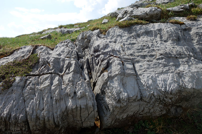
The starting point of this excursion is the picnic area near the II° Cantoniera of Stelvio. From the car park you should follow the National Road of Stelvio downhill for about 350 meters. When you arrive at the hairpin bend take the evident track that goes toward the heart of the Valle dei Vitelli. In a few minutes you will reach a little wooden bridge that allows you to cross the spectacular giant’s kettle. Here the trail goes up on an easy moraine scree and after about 300 meters, over a natural stone bridge, it brings you back to the orographic right of the river (pay attention in this section).
Following the indications to the “lago del mot” the track goes, for a few hundred meters, in the opposite sense of the valley until it meets the trail that arrives directly from the screes over the II Cantoniera (the trail that we will follow in our descent along the circular route). In this part some sections of the track are not always well marked or clearly visible but, regardless of this, the route is easy and obvious.
Once you meet the track that arrives uphill from the II Cantoniera turn right. Go uphill along the lower border of the scree that comes down from the “Filon del Mot”.
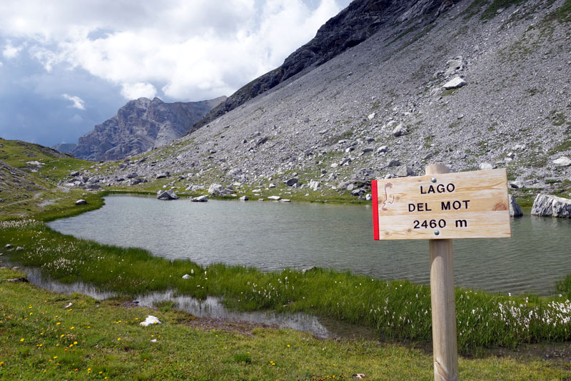
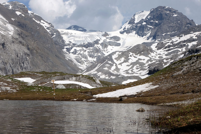
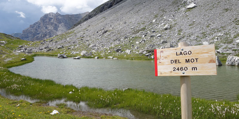
In a few minutes you will arrive at the striking Lake Mot, a little pearl 2400 meters above the sea. From here continue straight for about 500 meters until you reach an incredible panoramic point with a majestic view of the “valle dei Vitelli”, Monte Cristallo and the Stelvio glaciers.
On the way back, go back the way you came until the intersection between your uphill trail and the track from the II Cantoniera.
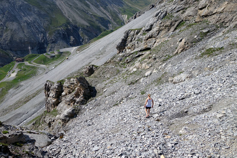
At the intersection, leave the uphill trail and go straight along the descending track. On scree, in some parts steep and awkward, you will reach the old hairpin bends of the Stelvio road near the starting point.
If you are not sure about walking downhill on scree you can follow the easier uphill road back.
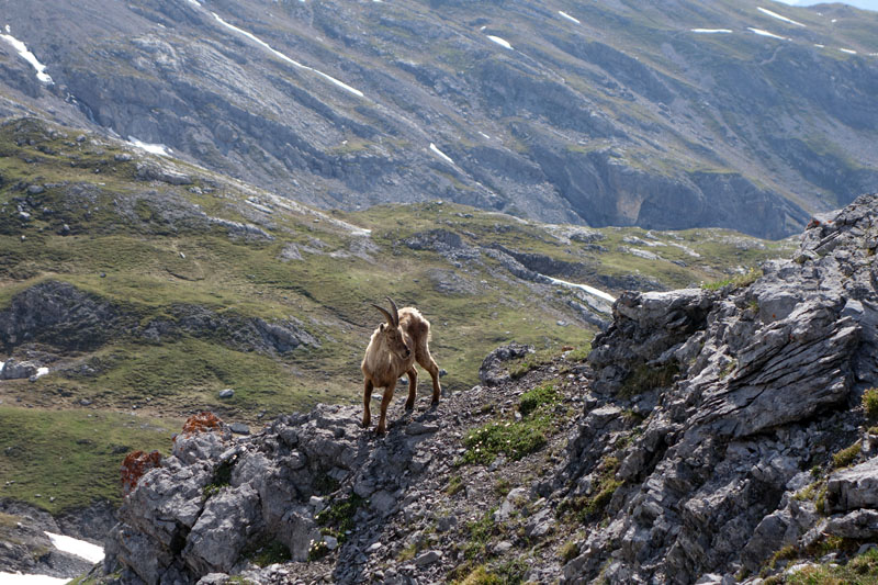
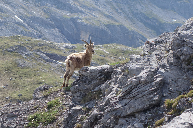
On the route it’s possible to see steinbocks, eagles, bearded vultures, marmots and frogs.
The Alpine flora is also precious with the presence of significant species like: gentians, buttercups, rhododendrons, soldanellas and achilleas (Taneda in our dialect).
Cultural points along the route: the giant’s kettle and the glacier valley “Valle dei Vitelli”
Enjoy your walk!
Stefano and all of the Albergo Adele staff
Text translated by Stefano Bedognè and Paul Faller (teacher at MyEnglish Lodi)


COPYRIGHT AND LEGAL POLICIES – UPDATED Mar. 9th 2021
All contents of this blog (text, graphic elements, images, pictures, videos, etc.) are exclusive property of Stefano Bedognè and Albergo Adele s.a.s. and they are protected by Italian and International copyright laws. Therefore only viewing is allowed. Copying, either partial or total, will be allowed only after explicit request and authorization. In this case it must be indicated on the copy the source: www.albergoadele.it. Any other use (distribution or publication for profit, modification, processing in any way or form, etc.) will be considered unauthorized and will be prosecuted by law.
The information provided on this page, on our website and on the blog in general, are finalized to promote the touristic and cultural opportunities of Bormio and Valtellina but they are not substitutions in any way for professional accompaniment or the direct consultation of professional workers.
All of the excursions described on this website are for the purposes of promoting Bormio and Alta Valtellina. Every hiker has to consider independently their physical condition, personal experience and ability. The hiker has to check independently the trail complexity based on personal conditions, trail conditions and weather conditions, including the presence of ice, snow, landslides, avalanches or other events. Albergo Adele and Stefano Bedognè don’t assume any responsibility for any accident occuring to the trekkers during the trip here described. Albergo Adele and Stefano Bedognè always suggest being accompanied by a Mountain Guide.
